
How a Mozambique District Map Helps in Creating Back-up Plans
District-Level Mapping for Risk Mitigation Planning
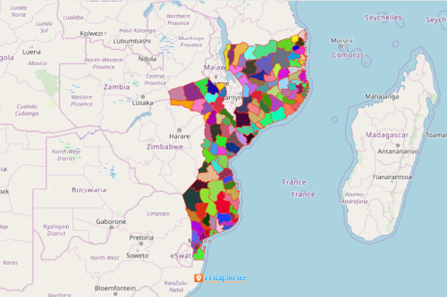
A risk mitigation software can be used in a Mozambique district map to produce a chunk full of ideas for back-up plans. Mozambique is divided into 10 provinces and 1 capital city (Maputo) with provincial status. There are 128 districts making up the provinces of Mozambique. When dealing with the challenges facing businesses today, it is important to create a back-up plan.
Using a district map of Mozambique allows the users to see a bird’s eye view of their network. The coverage tool is the best to use to easily see which areas fall outside your coverage. Service coverage maps and overlays instantly show greater visibility into how all your locations are performing. Moreover, when there are disruptions in your operation, distance analysis is the tool to use to make sure that help is instantly coming from the closest location.
Easily Create a Map of Mozambique Districts
Just follow these 10 simple steps. Once generated, start planning for risk mitigation.
- Create a Mapline account and login.
- Click the orange “Add New Items” button.
- Select “New Map” on the drop down arrow.
- Give your map a name and click “OK.”
- Click the “Add” button from the left sidebar.
- Select the “Territories” option.
- Click “From Mapline’s Repository.”
- From the “Territories” select “Mozambique Districts.” Use the search bar for quicker results.
- Select how you want your boundaries to be colored in “Fill Color” (Random Colors, Uniform Color, Dynamic heat map colors, or Custom colors from spreadsheet).
- Click “OK.”
That’s how easy it is to create a Mozambique District map! Once you have your map, you can create a map of Excel spreadsheet locations to overlay on top. Mapline also makes it simple to see summary information about the locations inside each district just by clicking on them! Sign up now and start creating back-up plans for your business!