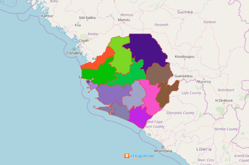
Take The Entrepreneurial World by Storm Using a Sierra Leone Map with Districts
Plotting Excel Data on a District Map Works Wonders
Sierra Leone map with districts. Sierra Leone is a country in West Africa that is rich in substantial minerals, particularly diamonds. It is divided into 14 districts. The district boundaries are further divided into 149 chiefdoms. Leveraging online mapping helps entrepreneurs to be more successful. Excel data overlaid on a district map ignites ideas and helps to understand trends in sales and marketing, reach out to customers, and learn about the competition.
Applying easy-to-use yet powerful mapping tools such as dot density, data segmentation, and distance calculation can be applied on a Sierra Leone map showing districts in the quickest possible time. These features address specific business needs that allow your organization to take the business world by storm!

Mapping Districts of Sierra Leone
This is the simplest way to generate a map with district boundaries:
- Create a Mapline account and login.
- Click the orange “Add New Items” button.
- Select “New Map” on the drop down arrow.
- Give your map a name and click “OK.”
- Click the “Add” button from the left sidebar.
- Select the “Territories” option.
- Click “From Mapline’s Repository.”
- From the “Territories” select “Sierra Leone Districts.” Use the search bar for quicker results.
- Select how you want your boundaries to be colored in “Fill Color” (Random Colors, Uniform Color, Dynamic heat map colors, or Custom colors from spreadsheet).
- Click “OK.”
That’s how easy it is to create a Sierra Leone map with districts! Mapline also makes it simple to see summary information about the locations inside each district just by clicking on them! Sign up now and get ready to take the business world by storm using powerful mapping tools!


