
Simplify Data Understanding with Somalia Region Map
Identify Useful Information Through Region-Level Mapping
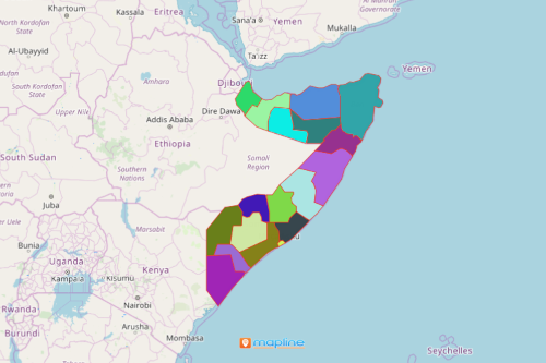
A Somalia region map tells many interesting geographical stories. These stories are used by different organizations to their own advantage. They find geographical patterns and data connections that are fitting for their decisions. Somalia is a country in Eastern Africa nestled between Ethiopia and Kenya. It consists of 18 regions which are subdivided into 90 districts. An Excel map with an overlay of region boundaries helps to identify useful information in data analysis, location selection, decision making, and guideline implementation.
Location data plotted on a region map of Somalia results in exceptional data discovery. Mapline has a comprehensive mapping application with unique techniques and features to help organizations understand geographical data better. Such features include heat mapping, routing, distance calculation, and more.
Save Time in Mapping, Spend More Time in Analysis
In just a few seconds, you can generate a region map of Somalia!
- Create a Mapline account and login.
- Click the orange “Add New Items” button.
- Select “New Map” on the drop down arrow.
- Give your map a name and click “OK.”
- Click the “Add” button from the left sidebar.
- Select the “Territories” option.
- Click “From Mapline’s Repository.”
- From the “Territories” select “Somalia Regions.” Use the search bar for quicker results.
- Select how you want your boundaries to be colored in “Fill Color” (Random Colors, Uniform Color, Dynamic heat map colors, or Custom colors from spreadsheet).
- Click “OK.”
That’s how easy it is to create a Somalia region map! Mapline makes it simple to see summary information about the locations inside each region just by clicking on them! Sign up now to start putting your data discovery in maximum use.