
Visualize Risk Area On-Site Using a Map of Sudan Showing States
State-Level Mapping for Risk Reduction Planning
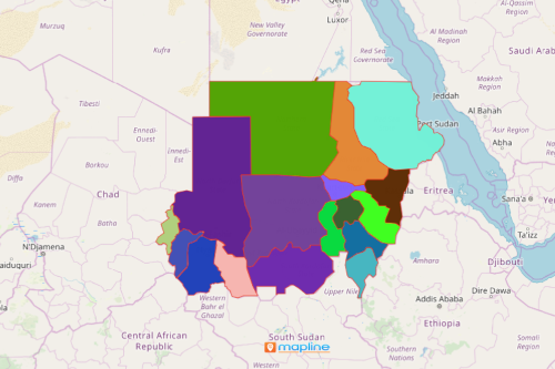
Companies in the oil and gas sector use a map of Sudan showing states. Sudan is a country located in Africa. It is divided into 18 states which in turn are further divided into 133 districts. The country is the third-largest country by area. It is the 17th fastest-growing economy in the world. The country’s economy depends largely on oil production. In the oil industry, it is highly important to know where risk areas are to minimize risks.
Map states of Sudan and add Excel data to reveal vulnerabilities. Use heat maps to monitor and manage risks. The distance calculator is used to prepare and plan for evacuations. When emergencies arise, using powerful mapping tools when analyzing a territory map saves both lives and properties!
Mapping State Boundaries to Streamline Risk Management Planning
In just a few seconds, a map of states of Sudan can be used in location analysis for risk reduction and management.
- Create a Mapline account and login.
- Click the orange “Add New Items” button.
- Select “New Map” on the drop down arrow.
- Give your map a name and click “OK.”
- Click the “Add” button from the left sidebar.
- Select the “Territories” option.
- Click “From Mapline’s Repository.”
- From the “Territories” select “Sudan States.” Use the search bar for quicker results.
- Select how you want your boundaries to be colored in “Fill Color” (Random Colors, Uniform Color, Dynamic heat map colors, or Custom colors from spreadsheet).
- Click “OK.”
That’s how easy it is to create a Map of Sudan showing states! Mapline also makes it simple to see summary information about the locations inside each state just by clicking on them! Sign up now to visualize risk areas and apply the necessary risk reduction planning.