ANGOLA PROVINCES
- Territory Guide
- ANGOLA PROVINCES
A map of Angola provinces is your ticket to skyrocketing your analysis and gaining insights in mere seconds! By visualizing your business activities across these provinces, you’ll quickly identify which areas are thriving and which might need a little extra focus. This clear view allows you to take swift, informed action to refine and optimize your strategies.
Ready to see your business operations bloom at full strength? Add Angola’s provinces to your map now and watch your strategies flourish!
WHAT ARE ANGOLA PROVINCES?
Angola, a Southern African country, is divided into 18 diverse provinces, each offering unique opportunities for businesses. For many brands, mapping these regions is essential for deep, meaningful analysis. By mapping out all 18 provinces, you reveal powerful insights that fuel smarter decisions and stronger strategies—turning information into action! A map of Angola provinces allows you to seamlessly analyze the distinct patterns within each province, empowering you to tailor your operations and elevate your business performance to new heights.
How thrilling could that be?
ADD ANGOLA PROVINCES
If you’re looking for ways to refine your day-to-day business activities, make sure that a map of Angola provinces with your data is on top of your analysis tools! It invokes a powerful visualization that produces actionable insights almost automatically. Apply these insights to enhance your business strategies on market penetration, resource allocation, or supply chain optimization.
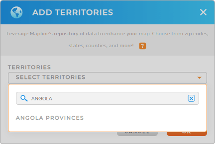
Start creating your map by adding a new territory from Mapline’s repository. In the search bar, type ANGOLA to trim down the selections. Click to add ANGOLA PROVINCES to your map.
Is that fast or what? Now, the next step is to color-code your province territory map.


Pro Tip: Leverage Mapline’s Territory Repository to supercharge your analysis. With its extensive list of worldwide territory boundaries—including Angola’s provinces—you’ll have the precise tools needed to conduct thorough territory analysis. Equip your strategies with accurate boundaries and watch as your insights become sharper, your decisions more informed, and your business operations more effective.
CHOOSE PROVINCE COLORS
Colors are a critical part of visualization. They bring out ideas that may be hidden in your rows of data. When static colors are applied to your territory map, you can visually differentiate between areas on your map. Use this type of color when presenting sales assignments to your team. On the other hand, patterns and data relationships can be quickly identified when you apply dynamic colors. This color style is perfect when analyzing high vs low-performing sales, or understanding the demographics in each province.
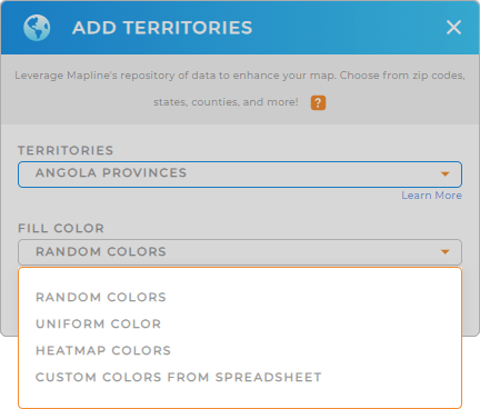
Choose the type of colors relevant to your analysis. You can choose from random colors, uniform color, heat map colors, or custom colors from spreadsheet. Once you have configured your color styles, click OK.
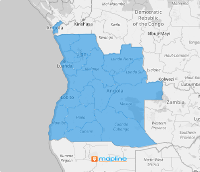
Now there’s your map of Angola provinces!

GET NEW TERRITORY INSIGHTS
Unveil new insights on your map of Angola provinces by leveraging these capabilities:
- Differentiate pins to represent different stages in the supply chain
- Add metrics to have an instant, up-to-date summary of your data
- Access your data behind your map visualizations in folder report


