
Reap the Benefits of Mapping Maldives Atolls
Atoll-Level Mapping for a More Defined Analysis
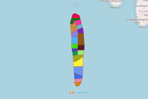
The 17 atoll councils in Maldives reap the benefits of mapping Maldives atolls and cities. As they study the geographical boundaries of each administrative atoll, they continue to learn the strengths and opportunities that lie within each boundary. Maldives is a pristine country located in Asia. It is made up of beautiful islands. Administratively, there are 189 islands, 17 atolls and 4 cities that comprise the country. When atoll boundaries are clearly defined on a map, they give relevant stories on which of the locations can be developed for potential tourist destinations, and which locations face risks.
Mapline offers a powerful mapping tool called heat maps. They are often used to represent areas with different colors. As they generate on a map, the users can initially determine how measurement varies – demographics, risk factors, supplies, and a lot more. The color gradients help speed up the data analysis. Through these colored gradients, the users are able to extract insights needed for decision making.
Mapping Maldives Atolls – not Just a Study of Geography
A map of atolls boundaries are easy to create. In just 10 easy steps, you can generate a map:
- Create a Mapline account and login.
- Click the orange “Add New Items” button.
- Select “New Map” on the drop down arrow.
- Give your map a name and click “OK.”
- Click the “Add” button from the left sidebar.
- Select the “Territories” option.
- Click “From Mapline’s Repository.”
- From the “Territories” select “Maldives Atolls and Cities.” You can also enter that on the search bar.
- Select how you want your boundaries to be colored in “Fill Color” (Random Colors, Uniform Color, Dynamic heat map colors, or Custom colors from spreadsheet).
- Click “OK.”
Sign up now and reap the benefits of using powerful mapping tools for your data analyses!