
Taiwan County Map Helps in Quick Response in Times of Crises
Safety and Security Planning with County-Level Mapping
Government offices and business owners alike trust a Taiwan county map to assess risks before, during, and after crises. Different crises have heightened the need to plan ahead to reduce risks significantly. They recognize that a county map guides them in times of crises. Moreover, it helps them address risk issues accordingly. Needless to say, risk management is something that can be done easily, thanks to mapping.
One way to monitor the impact of risks is to create heat maps. They show a vivid picture of the extent of a crisis. Because a heat map shows the “high activity” areas, the users are able to respond quickly to avoid setbacks, thereby saving lives, assets, and time.
Examine Each Area with a Taiwan County Map
Creating a map takes less than a minute. Then, you can start creating your backup plan.
- Create a Mapline account and login.
- Click the orange “Add New Items” button.
- Select “New Map” on the drop down arrow.
- Give your map a name and click “OK.”
- Click the “Add” button from the left sidebar.
- Select the “Territories” option.
- Click “From Mapline’s Repository.”
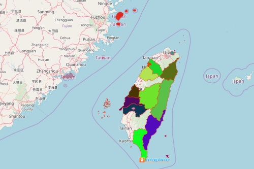
- From the “Territories” select “Taiwan Counties.” You can also enter that on the search bar.
- Select how you want your boundaries to be colored in “Fill Color” (Random Colors, Uniform Color, Dynamic heat map colors, or Custom colors from spreadsheet).
- Click “OK.”
Sign up now to start your long-term risk mitigation planning using smart mapping tools from Mapline.