AUSTRIA DISTRICTS
- Territory Guide
- AUSTRIA DISTRICTS
Transform your analysis with district-level mapping in Austria using Mapline. Mapping Austria districts provides brands with critical insights for improving regional operations, targeting specific markets, and optimizing resource allocation. For companies in logistics, sales, or service management, district-level data allows for more precise planning, route optimization, and customer engagement strategies. Harness this powerful territory map to unlock game-changing insights, fuel business growth, and spark innovation like never before!
Let’s dive into how mapping Austria districts can bring localized insights to your strategy and support better decision-making.
WHAT ARE AUSTRIA DISTRICTS?
Austria is divided into multiple districts, known as “Bezirke,” which serve as important administrative units for local governance, planning, and resource management. Each district has unique demographic, economic, and geographic characteristics, making district-level mapping valuable for brands looking to customize regional strategies, optimize delivery areas, or refine local marketing efforts. For businesses in logistics, sales, or field services, mapping Austria’s districts enables a targeted approach to customer segmentation, route planning, and operational efficiency. This district-level perspective allows businesses to adapt their strategies to local dynamics.
Mapping Austria districts empowers businesses with the regional insights needed to drive strategic, data-backed decisions and local impact.
ADD AUSTRIA DISTRICTS
Adding Austria districts to your Mapline map provides a structured approach to track performance, plan service areas, and allocate resources effectively. This district-based setup supports focused territory management and efficient route planning.
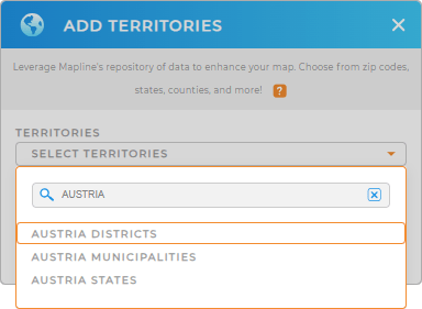
To get started, add a new territory from Mapline’s repository, type AUSTRIA in the search bar, and select AUSTRIA DISTRICTS from the dropdown.
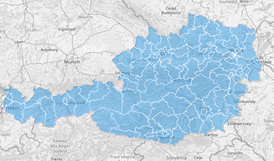
Your map is now ready to deliver actionable insights at the district level.


Pro Tip: Mapline’s global territory repository includes a comprehensive selection of administrative boundaries from around the world, making it easy to map regions and analyze data across multiple countries. This feature is ideal for companies operating in various regions or exploring new markets. Browse our repository to add boundaries including Austria states and Austria municipalities, that match your business objectives and unlock additional insights.
CHOOSE DISTRICT COLORS
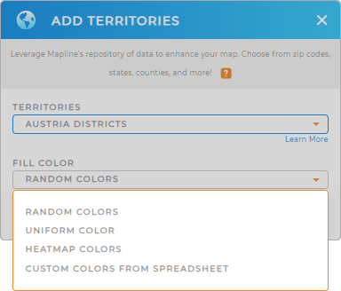
Applying colors to Austria districts on your map improves visual clarity, making it easy to assess performance, identify high-demand areas, and prioritize resources. Color-coded districts help your team quickly interpret data and focus on key regions at a glance.
To apply color styling, select your preferred color styling and enhance your map with clear, visual data insights that support smarter decision-making.

GET NEW TERRITORY INSIGHTS
Unlock the full potential of your Austria district map with Mapline’s advanced capabilities:
- Leverage coverage areas to understand service reach and pinpoint areas for expansion.
- Access demographic data with Mapline Data to explore population characteristics and economic insights within each district.
- Utilize folder reports to track performance by district and streamline your analysis.


