BELARUS REGIONS
- Territory Guide
- BELARUS REGIONS
Mapping out Belarus regions can significantly enhance your logistics management by providing detailed insights into your operational areas. Imagine being able to track the efficiency of your delivery routes and adjust them based on real-time data. With a clear view of regional performance, you can easily identify bottlenecks and optimize your resource allocation. This type of territory mapping helps you make informed decisions that improve service efficiency and customer satisfaction.
Start using Belarus region maps today to take your logistics strategy to the next level.
WHAT ARE BELARUS REGIONS?
Belarus regions, known as oblasts, are the main administrative divisions in the country, similar to states in the USA. Each region represents a significant area with its own local government and administrative responsibilities. By mapping out these regions, you can focus on specific areas to improve delivery efficiency and reduce travel time. This kind of detailed regional mapping allows you to see exactly where delays are occurring, enabling you to streamline operations and enhance your service. Understanding Belarus regions helps you optimize your logistics strategy, ensuring timely deliveries and better resource management.
ADD BELARUS REGIONS
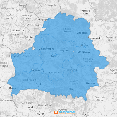
Adding Belarus regions to your map provides a comprehensive view of your operational territories, helping you identify areas for improvement.
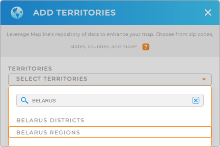
First, add a new territory from Mapline’s repository, type BELARUS into the search bar, and select BELARUS REGIONS.
This is a great way to get an accurate representation of your service activities within a given region, allowing you to optimize routes and improve overall efficiency.


Pro Tip: Mapline’s extensive list of territory boundaries allows you to add precise regional divisions to your map. Leverage our worldwide territory repository including Belarus districts and regions, to explore new opportunities and gain deeper insights into your logistics data.
CHOOSE REGION COLORS
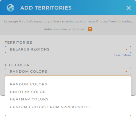
Territory colors are essential for business analytics and optimizing operations as they help you visualize performance metrics at a glance. Color-code your Belarus regions to quickly distinguish between different levels of service activity, making it easier to allocate resources effectively.
Simply select your desired color styling, then click OK. This powerful visual tool enhances your ability to make strategic decisions based on clear, color-coded data, ensuring your logistics operations run smoothly.

GET NEW TERRITORY INSIGHTS
Unlock more valuable insights that were previously hidden in your data by using these powerful capabilities:
- Identify underperforming regions and allocate additional resources for improvement
- Get an instant snapshot of all your job locations to keep your operations running smoothly
- Seamlessly import customer locations to access powerful insights without the hassle


