BHUTAN GEWOGS
- Territory Guide
- BHUTAN GEWOGS
Revolutionize your brand’s analytics as you harness the power of Bhutan gewogs! Gewog-level analysis may be new to you, but if you want to analyze local dynamics, make these smaller administrative units the focal point of your data analysis. This approach is crucial in optimizing delivery options. Visualizing your customers across various municipalities empowers you to make informed decisions to enhance your delivery services, making sure that you consistently adhere to timeframes. With a gewog-level analysis, not only did you boost your operational efficiency but you also built trust and satisfaction among your customers!
Get ready to reap granular insights by adding these regions to your map now!
WHAT ARE BHUTAN GEWOGS?
Bhutan is a stunning country nestled in the Eastern Himalayas with about 200 gewogs. These gewogs, formed by clusters of villages and overseen by gewog councils, represent the backbone of Bhutan’s local administration. Imagine being able to picture your data within these regions and help spark insights to tailor your strategies to fit local needs! Get ready to leverage this rich, regional insight and turn it into actionable strategies that drive success across Bhutan’s diverse gewogs!
Start your Bhutan gewog analysis now to reap valuable insights to maximize your efficiency leading to continuous business growth and success!
ADD BHUTAN GEWOGS
Gain laser-focus insights on customer insights as you add gewog boundaries to your map. Imagine having a crystal-clear visualization of the areas with the highest sales volumes and understanding what drives success in these regions! That is remarkable!
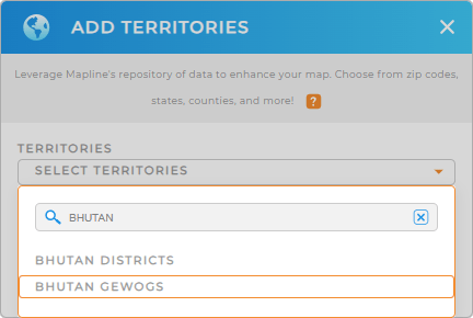
Get ready to add a new territory from Mapline’s repository. Type BHUTAN into the search bar and choose to click BHUTAN GEWOGS.
More seconds left on the timer – let’s now move on to apply colors to your Gewog map.


Pro Tip: Leverage Mapline’s extensive worldwide territory repository including Bhutan districts and gewogs to your analytics to intensify your strategic analysis capabilities. Explore other boundaries to compare your data and be surprised by location insights in heaps and bounds!
CHOOSE GEWOG COLORS
A color-coded gewog map is a powerful tool to interpret and visualize your data. Colors allow you to identify performance metrics, understand demographic trends, and spot regional patterns at a glance. Colors applied to your territory map significantly cut down the time you spend on analysis because you can instantly see which regions are high-performing, and underperforming, and which areas can be suitable for market penetration.
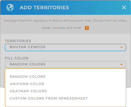
To modify your map to the best color styling that matches your type of analysis, choose from the selections: random colors, uniform color, heat map colors, and custom-colors from spreadsheet.
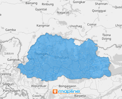
Click OK to finalize your selection. Now, there’s your map of Bhutan gewogs ready to be analyzed anytime, anywhere!

GET NEW TERRITORY INSIGHTS
Discover more hidden insights in your data as you leverage powerful capabilities to enhance your map of Bhutan gewogs:
- Apply coverage areas to spot both challenges and opportunities in that area
- Create smart sales routes to maximize your team’s time on the road
- Stay ahead of the game as you predict market trends and sales performance


