BOTSWANA DISTRICTS
- Territory Guide
- BOTSWANA DISTRICTS
If you want to enhance your strategic planning, you can never go wrong with analyzing your business performance on a map of Botswana districts. With a detailed district map, you can pinpoint exactly how things are going in every corner of Botswana. Reach a better understanding of how your business operates in each district. This clarity allows you to shift your focus to more targeted campaigns and strategies, tailored specifically to the unique needs and opportunities of each district.
Got 60 seconds or less? Get those boundaries added to your map now and discover how mapping Botswana districts can transform your business strategies!
WHAT ARE BOTSWANA DISTRICTS?
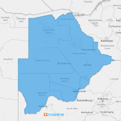
Botswana is a gem in Southern Africa divided into 16 distinct administrative districts—nine rural and six urban. This layout isn’t just about geography; it’s a golden opportunity to refine and supercharge your business strategies. Analyzing at a district level helps ignite sparks of insights that can revolutionize how you approach your business. This map gives you a close-up view of each district, allowing you to swiftly identify where adjustments are needed and where opportunities abound.
For instance, if you’re in the tourism industry, this map is your gateway to discovering new expansion areas. It reveals potential hotspots and local communities ripe for cultural tourism, helping you tap into regions that might have been previously overlooked. Imagine creating a new level of cultural engagement and tourism by understanding the unique offerings of each district.
That district-level mapping will put you on top of the competition!
ADD BOTSWANA DISTRICTS
A map of Botswana districts opens up a high-level overview that helps you drive informed decision-making and operational efficiency. Imagine seeing locations viable for your business expansion based on district-level insights! With those insights, you can develop new strategies tailored to the specific needs and opportunities of each district.
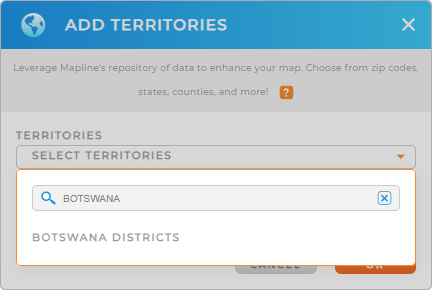
In just a few clicks, you can easily add a new territory from Mapline’s repository. Type BOTSWANA into the search bar and you’ll be directed to BOTSWANA DISTRICTS. Click to add it to your map.
We told you that was fast.


Pro Tip: Get the best out of leveraging Mapline’s Territory Repository for your territory analysis. Add multiple territories including Botswana districts to your map to explore new business opportunities.
CHOOSE DISTRICT COLORS
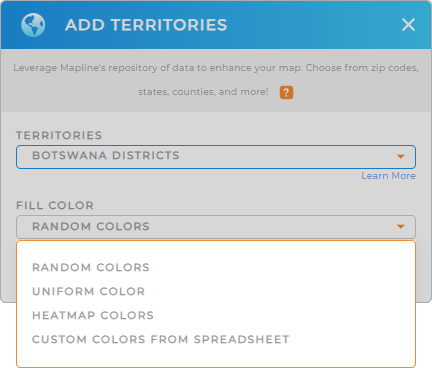
With the right territory added to your map, there’s only one step left – to apply color styling on your territories. A color-coded map is a powerful tool to visualize your data. With a color-coded district map, you can spot regional trends, understand demographic trends, and quickly identify performance metrics.
To customize your map, choose your preferred color styling. Then click OK.
That’s how you color-code your map!

GET NEW TERRITORY INSIGHTS
With your new map of Botswana districts in tow, you can:
- Level up your analysis by adding new data
- Customize your maps to tell your data’s story
- Plot the most optimal routes in seconds


