BULGARIA PROVINCES
- Territory Guide
- BULGARIA PROVINCES
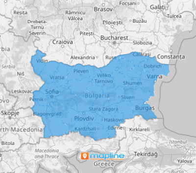
Add Bulgaria provinces to your map and enhance your business management! When you visualize these provinces, you can uncover detailed regional insights and pinpoint areas needing attention. Mapping Bulgaria provinces helps you identify regions with high demand, streamline resource distribution, and improve overall operational effectiveness. By understanding the geographical data, you can drive targeted strategies and boost your business’s performance.
Ready to leverage provincial data for better decision-making? Let’s get started!
WHAT ARE BULGARIA PROVINCES?
Bulgaria is divided into 27 administrative regions known as provinces, or oblasti. Each province has specific demographic and economic traits that can shape your business tactics. Mapping these provinces allows you to study regional patterns and customize your operations to suit local requirements.
Refine your daily business activities and provide actionable insights into market behavior and customer preferences with a Bulgaria province map. Provincial data can offer a comprehensive view of your business landscape, enhancing strategic planning and execution.
ADD BULGARIA PROVINCES
Formulate location-intelligent business plans, analyze provincial trends, and optimize highly-efficient routes.
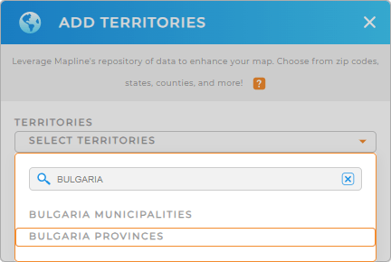
First, add a new territory from Mapline’s repository, type BULGARIA into the searchbar, and select BULGARIA PROVINCES.
This action lays the groundwork for a detailed and functional map tailored to your specific needs. There’s just one more quick step, and then you’re done.


Pro Tip: Mapline’s extensive repository of territory boundaries allows you to integrate regions from many countries into your map, enhancing your global operational reach. Explore various territories, including Bulgaria municipalities and provinces, to find the most effective approach for your business.
CHOOSE PROVINCIAL COLORS
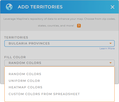
Assigning colors to each province on your Bulgaria map is essential for clear data visualization. By using different colors for each province, you can quickly detect performance patterns and make informed operational decisions. Select your desired color styling, then click OK.
This visual differentiation allows you to spot regional patterns at a glance, making it easier to implement targeted strategies and improve overall efficiency.

GET NEW TERRITORY INSIGHTS
Now, the power of territory analytics is right at your fingertips. Discover additional insights previously hidden in your data with these advanced capabilities:
- Calculate the distance between locations within provinces to optimize delivery routes and reduce travel time
- Access detailed reports on each province’s performance–compare and identify regions that need improvement or have growth potential
- Segment your audience based on provincial data to create targeted marketing campaigns that resonate with local demographics and preferences


