CANADA CENSUS DIVISIONS
- Territory Guide
- CANADA CENSUS DIVISIONS
Gain a strategic edge by mapping Canada’s census divisions with Mapline. Mapping these divisions across Canada allows brands to improve logistics, target specific markets, and allocate resources effectively. For companies in sales, service management, or regional planning, census division mapping helps reveal population trends, customer distribution, and operational needs. By visualizing your business performance at the census division level, your team can make informed decisions that align with regional demand and support long-term growth.
Let’s dive into how mapping Canada’s census divisions can enhance your business strategy and provide valuable regional insights.
WHAT ARE CANADA CENSUS DIVISIONS?
In Canada, census divisions are administrative areas that help organize demographic and geographic data for analysis, and they typically align with counties, regional districts, or other local governmental units. Each division provides essential data for understanding local demographics, economic activity, and community characteristics. For businesses in logistics, sales, or service delivery, mapping Canada’s census divisions offers a focused approach to customer segmentation, resource planning, and region-specific strategy. This census division view enables brands to align operations with local characteristics, supporting efficient and impactful decision-making.
Mapping Canada’s census divisions gives brands access to localized data that supports strategic planning and helps improve regional performance.
ADD CENSUS DIVISIONS
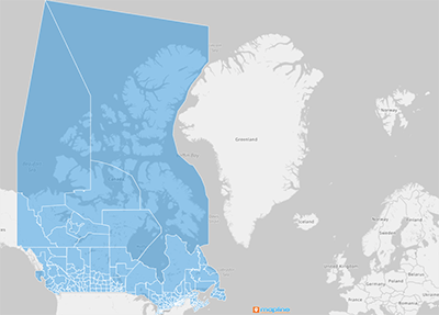
Adding Canada’s census divisions to your Mapline map provides a structured approach to monitor operations, plan routes, and analyze customer reach across specific regions. This division-level setup supports territory management and allows for targeted analysis.
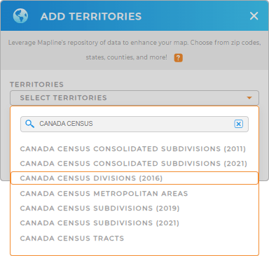
To get started, add a new territory from Mapline’s repository, type CANADA in the search bar, and select CANADA CENSUS DIVISIONS from the dropdown.
Your map is now equipped to deliver actionable insights at the census division level.


Pro Tip: Mapline’s Repository provides a comprehensive list of territory boundaries for Canada. Select the most recent year from the drop-down to access the most up-to-date administrative boundaries from the Canadian government! Plus, explore other administrative boundaries, such as Canada agricultural regions, Canada CMAs, or Canada census subdivisions. Adding different areas to your map is a fantastic way to discover how different regional trends impact your operations!
CHOOSE DIVISION COLORS
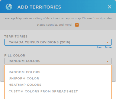
Applying colors to Canada’s census divisions on your map makes data patterns instantly visible, allowing your team to prioritize regions, track performance, and easily identify market opportunities. Color-coded divisions help your team quickly interpret data and focus on high-impact areas.
To apply color styling, select your preferred color styles and bring clarity to your map, making insights more accessible and actionable.

GET NEW TERRITORY INSIGHTS
Enhance your Canada census division map with Mapline’s advanced tools:
- Analyze coverage areas to assess service reach and identify regions for potential expansion.
- Use Mapline Data’s demographic insights to understand population characteristics within each census division.
- Set up folder reports to streamline data review and monitor key performance metrics by division.


