Canada Designated Places
- Territory Guide
- Canada Designated Places
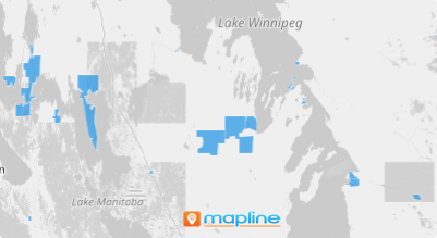
Add Candada Designated Places to your map in seconds and hone in on key insights that enhance your business operations and strategic planning! Stay ahead of the game by swiftly identifying challenges, optimizing territory management, and making data-driven decisions with confidence.
What makes this territory unique is that you can focus your analysis on certain communities or settlements that are less than 10 square kilometers with less than a thousand population. With a sharper view of regional dynamics, you can proactively tackle risks, seize opportunities before the competition, and navigate complex situations with precision.
Ready to get started? Let’s dive in!
WHAT ARE CANADA DESIGNATED PLACES?
Canada designated places (DPLs) are communities or settlements that doesn’t meet the criteria of a municipality. These areas are smaller than a census subdivision or population center and have an area of 10 square kilometers or less.
For businesses, adding Canada designated places to a map can offer insights into population distribution, consumer demographics, and market potential.
ADD DPLs TO MAP
Enhance your map with these specialized boundaries and gain instant clarity on both opportunities and risks. By exploring insights at this level, you gain a strategic advantage—an insider’s view that lets you seize opportunities with precision.
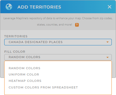
It only takes a few seconds to add Canada designated places to your map in Mapline! First, add a new territory from Mapline’s repository. Then, type CANADA DESIGNATED in the searchbar and select CANADA DESIGNATED PLACES.
It’s as easy as that! Now let’s move on to the next step.


Pro Tip: Mapline offers an extensive list of territory boundaries for Canada. Leverage Canada population centers, Canada agricultural regions, Canada census metropolitan areas, and more.
CHOOSE DPL COLORS
Add colors to your map and enhance your analytics! Colors are the perfect way to reveal powerful insights and drive smarter decisions!
Simply select your desired color style and click OK.
It couldn’t be any easier to add custom colors to your map in Mapline.

GET NEW TERRITORY INSIGHTS
It doesn’t stop there! Get the most out of your Canada designated places map with these powerful capabilities:
- Group and sort data that transform raw information into meaningful categories that enhance operational efficiency
- Calculate drive distances and pinpoint the best areas for growth or focus
- Uncover location-relevant insights from Mapline’s exclusive territory database


