CROATIA CITIES AND MUNICIPALITIES
- Territory Guide
- CROATIA CITIES AND MUNICIPALITIES
Staying ahead of the competition requires foresight and there’s no better way to do it than to analyze your business performance on a map of Croatia cities and municipalities. In today’s competitive landscape, the fastest way to stay on top of the curve is to get an overview of your operations in a territory map with granular boundaries. This is where the city and town boundaries are most helpful. They provide smaller areas but with a larger scope for gaining hyper-local ideas and factors that help streamline your operational efficiency.
Seamlessly incorporate a Croatia city and municipality map into your analytics and strategic planning to ensure that you remain a step ahead in your industry.
WHAT ARE CROATIA CITIES AND TOWNS?
Croatia is a country at the crossroads of Central and Southeast Europe. In 2013, there were a total of 128 cities and towns in the country. They perform local tasks including zoning and urban planning, consumer protection, and local transport. Cities and towns are urbanized areas in Croatia with the following requirements:
- should be the center of a county
- has more than 10,000 residents
- defined where historical, economic, or geographic reasons exist
Get a clear overview of your operations and your competitors on a map! Maximize the full potential of a cities and municipalities map to understand your market environment thoroughly.
ADD CROATIA CITIES AND MUNICIPALITIES
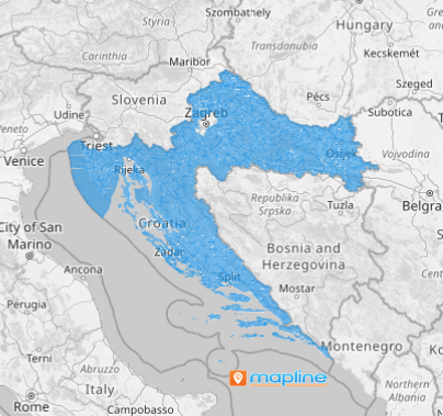
Adding Croatia cities and municipalities to your map gives you a clear view of regional performance. Now, identifying new markets or refining your approach in existing ones has never been easy!
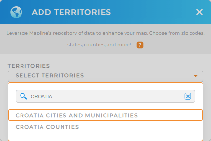
To make sure you add the right territory, start to add a new territory from Mapline’s repository. Type CROATIA into the search bar and select CROATIA CITIES AND TOWNS to add.
With the right territory added, let’s splash some colors into your map.


Pro Tip: Mapline’s territory repository includes an extensive list of boundaries including Croatia cities and municipalities and Croatia counties. Level up your territory analysis as you add different territories to explore untapped opportunities for your business.
CHOOSE CITY AND MUNICIPALITY COLORS
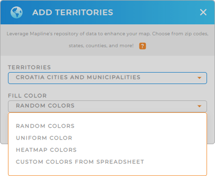
Territory colors are an integral part of business analytics. They help you visualize performance metrics at a glance. Color-code your territory to quickly distinguish underserved or high-potential areas and identify growth opportunities.
Just select your desired color styling from the drop-down menu, then click OK. This powerful visual tool enhances your data-driven decision-making leading to better outcomes.

GET NEW TERRITORY INSIGHTS
Now, watch your analytics transform as you apply these powerful capabilities:
- Segment your data to identify vulnerabilities or areas prone to issues
- Leverage distance calculations between your center points and other locations on your map
- Monitor real-time performance of your team to understand your team’s behavior


