CZECH REPUBLIC DISTRICTS
- Territory Guide
- CZECH REPUBLIC DISTRICTS
Add Czech Republic districts to your map to visualize customer locations, giving you clarity on market saturation and unlock new opportunities. Visualizing untapped opportunities on a district territory map is like having x-ray vision for your market. You’ll dive deep into customer demographics, pinpointing where your most promising prospects are and where the competition is weakest. This insight isn’t just eye candy; it’s your roadmap to making powerful, data-driven decisions. Think of it as your secret weapon to strategize expansion with confidence and precision.With these tools, you’re not just managing your business—you’re mastering it!
Think about that! All because of a powerful visualization of a Czech Republic district map.
WHAT ARE CZECH REPUBLIC DISTRICTS?
The Czech Republic, also known as Czechia, is a country nestled in the heart of Central Europe with 75 distinct districts. While these district boundaries may no longer serve as the official second-level administrative divisions, they’re still very much alive in the realm of business strategy. Imagine having a map that not only shows you where your markets are but also helps you strategically distribute your resources based on actual demand in each district. By leveraging these district maps, you’re not just navigating the business landscape; you’re conquering it with pinpoint accuracy.
Leveraging a map of Czech districts helps to allocate your resources more efficiently based on demand in each district.
ADD CZECH DISTRICTS
Enhance your customer satisfaction with timely and effective service delivery by analyzing on a district-level. Unlock new levels of efficiency once you analyze how your business performs within each district boundaries.
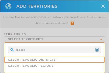
You don’t need to be super professional to add district boundaries to your map. In Mapline, we make it the easiest for you to add a new territory from Mapline’s repository. Type CZECH into the search bar and select CZECH REPUBLIC DISTRICTS.
Just a few more clicks and we’re done.


Pro Tip: The 76 districts of Czech Republic were replaced in 2002 to give way to 393 Administrative Districts of Municipalities with Commissioned Local Authority.
CHOOSE DISTRICT COLORS
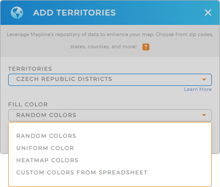
The next step is to color-code your territories. Using random colors, you can assign pre-defined colors to each district making them easily recognizable. Mapline provides other type of colors to help you with your analysis. Whether you want to identify regional trends, monitor performance, or optimize your operations, we got the best color styles for you!
Configure the type of colors you prefer from the drop-down menu, then click OK.
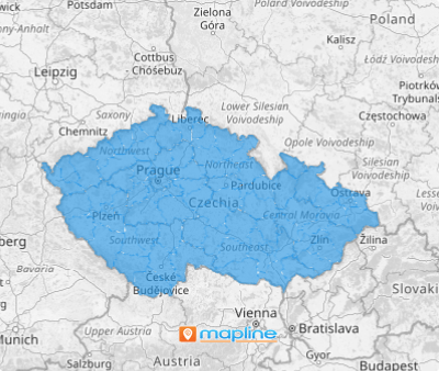
Now, there’s your powerful mapping visual of Czech districts!

GET NEW TERRITORY INSIGHTS
Unlock more valuable insights hidden in your data as you apply these powerful capabilities:
- Segment your data to focus on high priority areas
- Evaluate response times in different districts to improve efficiency
- Predict future demand across districts to identify patterns for improvement


