ENGLAND REGIONS
- Territory Guide
- ENGLAND REGIONS
A map of England regions is a powerful tool offering unparalleled insights into regional dynamics. Imagine you’re a sales manager looking to skyrocket your performance in the England market. By exploring a map of England’s regions, you can uncover valuable trends that highlight hidden opportunities across various regions. This level of detailed analysis sharpens your strategies, helping you fine-tune your approach to maximize sales.
Ready to elevate your strategy and achieve new heights of success? Start harnessing the power of provincial insights today!
WHAT ARE ENGLAND REGIONS?
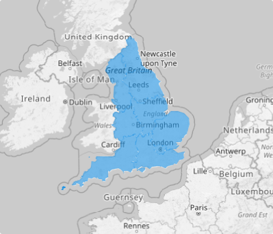
England, a key country within the United Kingdom, occupies about 62% of the island of Great Britain and is complemented by over 100 smaller islands. Its regions represent the highest tier of sub-national divisions, mainly used for statistical analysis.
Mapping England’s regions offers invaluable insights into local trends, helping businesses understand consumer behavior, optimize distribution networks, and fine-tune marketing strategies. By integrating these regional boundaries into your map, you’ll be equipped to make more informed, data-driven decisions that can enhance your operations and boost your competitive edge.
ADD ENGLAND REGIONS
Mapping England’s regions is a game-changing strategy that brings clarity, uncovers key insights, and unlocks new opportunities for growth and efficiency. Let’s get started and unlock the power of regional analysis!
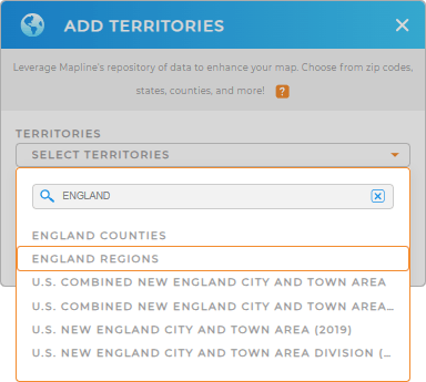
First, add a new territory from Mapline’s repository. Then, type ENGLAND in the search bar and select ENGLAND REGIONS.
Ready to unlock your business’s full potential? Let’s go ahead and apply territory colors and transforming your strategy!


Pro Tip: Mapline’s worldwide territory repository provides different territory boundaries for England including England counties, England ceremonial counties, and regions, to gain comprehensive insights into your data.
CHOOSE REGION COLORS
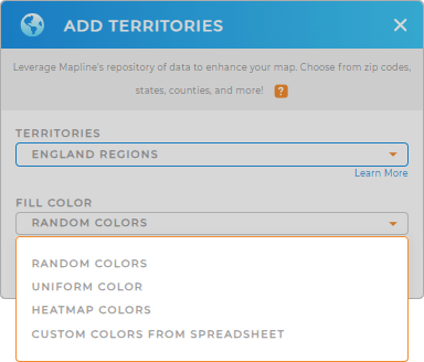
Mapline provides static and dynamic colors. Static colors provide a straightforward way to distinguish regions, offering clear and simple visual separation. Dynamic colors can highlight trends, track changes, and uncover insights at a glance.
Turn your map into an insightful visualization that speaks volumes as you choose the best color styling option from Mapline’s exceptional color styles. After configuring your settings, click OK to start exploring valuable insights on your map of England regions.

GET NEW TERRITORY INSIGHTS
Here are some capabilities that can help you get more from your England region map.
- Make complex data easy to understand and facilitate better decision-making
- Create a data-driven calendar designed to keep your business moving
- Craft hyper-efficient automated routes in seconds!


