ESTONIA MUNICIPALITIES
- Territory Guide
- ESTONIA MUNICIPALITIES
Unlock smarter decisions and faster growth by adding Estonia municipalities to your Mapline map. A municipality map empowers brands by delivering sharp insights that help optimize operations, improve logistics, and fine-tune marketing efforts. Estonia’s municipal boundaries reveal clear patterns in customer distribution, resource allocation, and service regions – all essential for guiding strategic moves. Plus, this map lets you identify growth opportunities and adapt to market demands, creating a seamless bridge between your data and real-world impact.
Ready to transform how you view your business performance? Mapline makes it easy to add these territories and jump-start your analytics!
WHAT ARE ESTONIA MUNICIPALITIES?
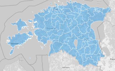
Estonia is divided into municipalities, which are local government units responsible for administration, public services, and development at a local level. The country has 79 municipalities, split into 15 urban and 64 rural areas, each with distinct regional characteristics. Businesses can leverage a municipality map to target specific areas for marketing, identify new sales regions, or optimize dispatch and logistics operations with precision. With this map, brands in industries like sales, marketing, and logistics can uncover region-specific insights, improve resource allocation, and serve customers more effectively.
Mapping Estonia’s municipalities helps you sharpen your strategy and make data-driven decisions that align with local demand.
ADD MUNICIPALITIES
Adding Estonia municipalities to your Mapline map lets you centralize valuable location-based data, providing a high-level view of customer reach, logistics efficiency, or market potential. This visualization transforms complex datasets into actionable insights, enhancing how your brand strategizes and operates across different regions.
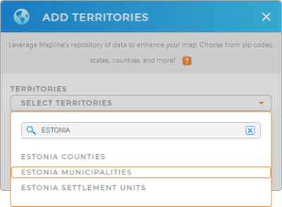
To add this territory, add a new territory from Mapline’s repository, type “Estonia” into the search bar, and select “ESTONIA MUNICIPALITIES” from the dropdown. With this setup, you’re ready to layer deeper insights onto your operations!


Pro Tip: Mapline’s global territory repository offers an extensive list of territory boundaries for every need, allowing you to add Estonia territories including Estonia counties, Estonia settlements, and municipalities. Use this powerful resource to explore new market areas, support global planning, or manage multi-national logistics with precision and confidence. Browse our territory boundaries and unlock the world of possibilities on your map.
CHOOSE MUNICIPALITY COLORS
Applying colors to your Estonia municipality map is a quick way to reveal critical data patterns that drive business decisions. Color-coding enhances visual clarity, making it easy to assess region-specific performance, identify high-demand areas, and optimize your service coverage.
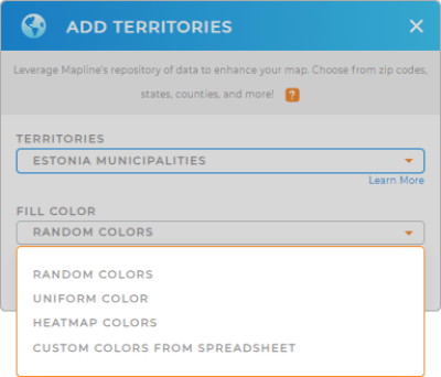
To color your municipalities, select your preferred color styling from the drop-down menu and finalize your choice. With a single glance, you’ll have a vivid picture of where to focus resources and drive growth.

GET NEW TERRITORY INSIGHTS
With Estonia municipalities mapped out, dive deeper to discover previously hidden insights and transform your data into powerful analytics:
- Access Mapline Data to explore demographic information, giving you a clear view of population trends that inform targeted campaigns and outreach.
- Create forms to effortlessly gather on-site insights
- Use filters to segment data based on performance, identifying the regions that drive the most value for your brand.


