ETHIOPIA DISTRICTS
- Territory Guide
- ETHIOPIA DISTRICTS
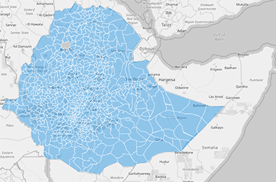
Supercharge your business insights by adding Ethiopia’s districts to your Mapline map. A district map enables brands to dig deeper into local dynamics, optimize service coverage, and fine-tune logistics with high accuracy. With Ethiopia’s district boundaries, you can spot trends in specific areas, streamline deliveries, and enhance sales strategies. This localized view makes it easier to align your operations with real-world demands, uncovering actionable insights and driving impactful decisions.
Ready to see how Ethiopia’s district map can make a difference? Let’s dive into the steps.
WHAT ARE ETHIOPIA DISTRICTS?
Ethiopia, a diverse country in the Horn of Africa, is divided into multiple districts, known as woredas, within each region. Each district serves as a crucial administrative unit for managing resources, public services, and economic activities at a local level. For brands in sales, logistics, and operations, mapping these districts enables targeted analysis and supports a refined approach to resource allocation, customer outreach, and performance tracking. This district-level visibility helps your team tailor strategies to specific areas, improving service efficiency and customer engagement.
Mapping Ethiopia’s districts empowers brands to make regionally focused, data-driven decisions with confidence.
ADD ETHIOPIA DISTRICTS
Adding Ethiopia’s districts to your map allows you to manage and monitor operations with precision, ensuring each area receives the right level of focus. With district boundaries mapped, it’s easier to understand demand patterns, evaluate coverage, and optimize your workflows.
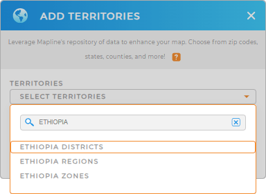
To add these districts, add a new territory from Mapline’s repository, type ETHIOPIA in the search bar, and select ETHIOPIA DISTRICTS from the dropdown. This sets you up to explore your data with a local focus.


Pro Tip: Mapline’s extensive repository of global territories lets you visualize administrative boundaries across multiple countries. This capability opens doors for businesses looking to analyze international markets, adjust operations globally, and gain a regional perspective. Browse our territory repository to add Ethiopia regions, Ethiopia zones, and districts, as new dimensions to your map and maximize your strategic insights.
CHOOSE DISTRICT COLORS
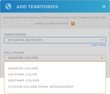
Applying colors to Ethiopia’s district map enhances your ability to see patterns and trends in the data, making it easier to track performance, plan resources, and make swift decisions. With color-coded districts, you’ll see market hotspots, optimize service coverage, and pinpoint growth areas at a glance.
To style your map, choose your preferred color styling and bring clarity to your district insights.

GET NEW TERRITORY INSIGHTS
Transform your Ethiopia district map into an analytic powerhouse with Mapline’s advanced capabilities:
- Generate center points to analyze optimal locations and understand coverage across districts
- Leverage segments to categorize and differentiate data, helping you focus on high-priority areas
- Create instant customer and delivery maps to track real-time data on customer locations and service activities


