
Understand Market Better with a Hungary District Map
Let a District-Level Map Shape Your Business Strategies
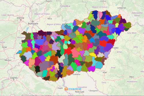
Companies use a Hungary district map to understand their competitive advantage. Hungary is a country located in Europe. It is divided into 174 districts. Successful companies recognize the value of district-level mapping to fully understand their market. Their decisions and plans are driven by the right understanding of what their customers prefer and value. Hence, mapping tools for location and data analysis is vital. Tools like Excel spreadsheet mapping or territory mapping results in insight that organizations use to understand customer expectation and engagement.
As a mapping software, leading business executives only trust Mapline to provide them with data visualization that is necessary in decision making. It empowers the users to look inside thousands of location data and boundaries to know where their business leads. The right mapping tools such as heat mapping or distance calculator help to answer customer-centric questions such as which stores are the most accessible to customers, what are the potential risks, or which stores offer delivery services.
Know Your Customers with a Hungary District Map
Adding more data equates to more insights that can be extracted. These in turn lead to right choices to manage the business. Thus, it is highly imperative to build a map with district boundaries:
- Create a Mapline account and login.
- Click the orange “Add New Items” button.
- Select “New Map” on the drop down arrow.
- Give your map a name and click “OK.”
- Click the “Add” button from the left sidebar.
- Select the “Territories” option.
- Click “From Mapline’s Repository.”
- From the “Territories” select “Hungary Districts.” You can also enter that on the search bar.
- Select how you want your boundaries to be colored in “Fill Color” (Random Colors, Uniform Color, Dynamic heat map colors, or Custom colors from spreadsheet).
- Click “OK.”
Be one of the most innovative business organizations that use Mapline as location intelligence! Drive more success to your business. Sign up now to start creating maps as your go-to source of location information.