ITALY MUNICIPALITIES
- Territory Guide
- ITALY MUNICIPALITIES
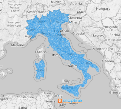
Turbocharge your growth with a map of Italy municipalities. Imagine having a clear, detailed view of your business performance across the 7,918 municipalities! By analyzing insights within each boundary, you gain a strategic edge—whether you’re scouting the perfect location for expansion, identifying growth opportunities, or refining your next big move.
Don’t waste time! In just seconds, you can create a powerful municipality map and unlock the tools to visualize insights like never before. With this map at your fingertips, you can effortlessly uncover connections, spot trends, and analyze with precision—empowering smarter, faster, and more impactful decision-making.
WHAT ARE ITALY MUNICIPALITIES?
At the heart of Italy’s governance are its 7,918 municipalities—the building blocks of local administration and community life. But here’s where it gets exciting: savvy brands are tapping into the power of mapping tools to unlock hidden opportunities. By analyzing data through the lens of these boundaries, businesses are discovering powerful patterns and unexpected relationships. These insights aren’t just numbers—they’re roadmaps to smarter strategies, revealing where to grow, how to connect, and where to invest.
The result? Transformative decisions that drive strategic growth, innovation, and success!
ADD ITALY MUNICIPALITIES
From identifying key market opportunities to optimizing your operations, this comprehensive territory map helps you make smarter, more strategic decisions that drive success.
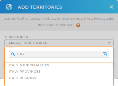
Start exploring today and elevate your business to new heights! To make your map creation easy, just add a new territory from Mapline’s territory. In the search bar, type ITALY and choose ITALY MUNICIPALITIES.
How convenient is that?


Pro Tip: Mapline’s repository is your gateway to a world of possibilities, featuring an extensive collection of boundaries from countries around the world including Italy municipalities, Italy provinces, and Italy regions.
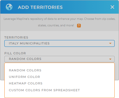
CHOOSE MUNICIPALITY COLORS
With the right territory selected, it’s time to transform your territory map into a strategic powerhouse by applying colors. Color-coding your territories cuts analysis time in half, delivering instant clarity and helping you spot patterns and trends at a glance.
Choose the color styling that amplify trends and unlock hidden opportunities. Once you click OK, your customized map of Italy’s municipalities is ready to power smarter, data-driven decisions—with confidence and speed!

GET NEW TERRITORY INSIGHTS
Delve deeper into data and territory analyses with these advanced capabilities:
- Analyze customer behavior when you segment your data
- Run a comprehensive market analysis in minutes
- Segment your data to compare high-performing vs underperforming stores


