
Prepare for Natural Disasters with a Map of Malta Islands
Mapping Island Boundaries for Efficient Risk Monitoring
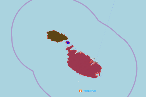
A map of Malta Islands is a go-to for local government agencies to monitor the communities before disasters strike. Malta is a beautiful island country that is made up of 3 major islands – Malta, Comino and Gozo. Overlaying the island boundaries on a map helps the government officials to clearly see the areas which may be impacted by potential hazardous elements. Some risks that may affect the country are droughts, storms, and landslides. When these happen, the country’s economy, safety and security will be affected. Hence, it is very critical to use a map with island borders as a guide to better understand the locations.
A mapping tool called heat map is the key to answer the “what,” “where,” and “how” questions. It produces color gradients to determine the locations that are more vulnerable to risk factors. Thus, government agencies can quickly apply smarter risk monitoring and management.
Shared Map for Public Safety
Mapline’s territory map can be generated in just a few seconds. Once generated, it can be shared or embedded on a website. The map may serve as a public education program for the whole community.
- Create a Mapline account and login.
- Click the orange “Add New Items” button.
- Select “New Map” on the drop down arrow.
- Give your map a name and click “OK.”
- Click the “Add” button from the left sidebar.
- Select the “Territories” option.
- Click “From Mapline’s Repository.”
- From the “Territories” select “Malta Islands.” You can also enter that on the search bar.
- Select how you want your boundaries to be colored in “Fill Color” (Random Colors, Uniform Color, Dynamic heat map colors, or Custom colors from spreadsheet).
- Click “OK.”
Indeed, it takes a community to prepare for a disaster. Therefore, data and territory mapping is necessary to prepare the community for any possible disaster. Sign up now to learn more on how mapping tools can be of value for disaster preparedness.