
Mapping North Macedonia Municipalities to Enhance Communication During Pandemic
Share a Map of Municipalities to Different Agencies for Better Collaboration
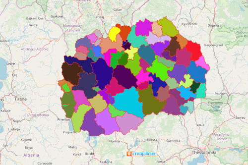
For local government units, mapping North Macedonia municipalities seems to be a smart move to learn about the health system on a municipality level. Since 2013, North Macedonia has been divided into 80 municipalities. Especially in times of pandemic, each local government should waste no time to try to combat the spread of the virus. At the same time, they are eager to beat time to protect their constituents. Hence, mapping municipality boundaries is a great help to visualize the impact of the virus, vaccine programs, quarantine activities, hospitals and clinic monitoring, and many more.
A map of municipalities can be used by different agencies so they can all function as one unit. Mapline makes it possible for the maps to be shared in seconds. Agency leaders can gain access to edit the maps as needed and even embed the map on a website. Shared maps make collaboration better. In addition, communication within the local government agencies is seamless.
Create a Map For a Better Health Monitoring Program
Maps with municipal boundaries are easy to create. As your map generates after a minute, add Excel spreadsheet data layers and begin your data analysis to detect new insights for enhanced communication.
- Create a Mapline account and login.
- Click the orange “Add New Items” button.
- Select “New Map” on the drop down arrow.
- Give your map a name and click “OK.”
- Click the “Add” button from the left sidebar.
- Select the “Territories” option.
- Click “From Mapline’s Repository.”
- From the “Territories” select “North Macedonia Municipalities.” You can also enter that on the search bar.
- Select how you want your boundaries to be colored in “Fill Color” (Random Colors, Uniform Color, Dynamic heat map colors, or Custom colors from spreadsheet).
- Click “OK.”
Sign up now to know about more mapping tools that help enhance communication and collaboration as you speed up your data analysis.