FAROE ISLANDS REGIONS
- Territory Guide
- FAROE ISLANDS REGIONS
Mapping the Faroe Islands regions can transform how your business operates in this remote yet dynamic location. By visualizing regional boundaries, you can uncover patterns, optimize operations, and plan smarter strategies that are tailored to the unique geography of this island nation.
With Mapline, creating these insights is simple and effective. Let’s explore how location analytics impacts your brand and improves your operations!
WHAT ARE FAROE ISLANDS REGIONS?
The Faroe Islands, an autonomous territory within the Kingdom of Denmark, consists of six administrative regions. These regions reflect the islands’ unique geography and demographics, offering critical insights for businesses operating in the area.
A map of the regions of the Faroe Islands allows you to identify service areas, manage logistics across islands, and better understand market opportunities. This makes it a valuable tool for businesses in industries like logistics, tourism, and retail.
ADD REGIONS TO MAP
Expand your reach and unlock powerful insights when you add region boundaries to your map.
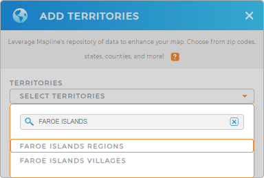
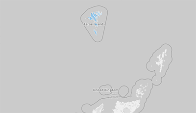
To get started, add a new territory from Mapline’s repository. Open the territory search bar, type FAROE and select FAROE ISLANDS REGIONS. Once added, you’ll have a detailed map that breaks down the islands into manageable territories for analysis and planning.
With the regions displayed, you can begin analyzing customer data, resource distribution, and operational efficiencies across the islands.


Pro Tip: Check out Mapline’s repository of worldwide territory boundaries! Dive into new insights as you explore how analyzing your business strategies on maps of Faroe Islands villages and regions can impact your business.
CHOOSE REGION COLORS
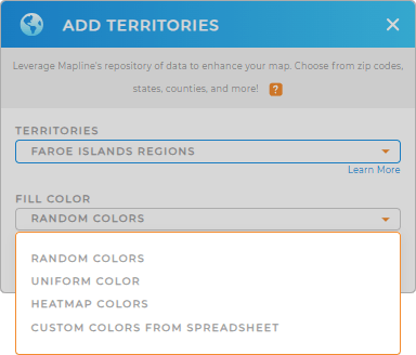
Enhance your map’s visual clarity by applying region colors. Choose the color styles that aligns with your analysis goals, whether it’s static colors for priority areas or dynamic colors to reflect real-time data updates.
Color-coded maps make it easy to identify trends at a glance, helping you make decisions quickly and confidently.

GET NEW TERRITORY INSIGHTS
Mapline’s tools make it easy to extract actionable insights from your map. Here’s what you can do with your region map:
- Harness automated last-mile routing!
- Get a laser-sight on your operations with geographic business intelligence
- Optimize your vehicle management and get a real-time overview of your entire fleet, 24/7


