FRANCE DEPARTMENTS
- Territory Guide
- FRANCE DEPARTMENTS
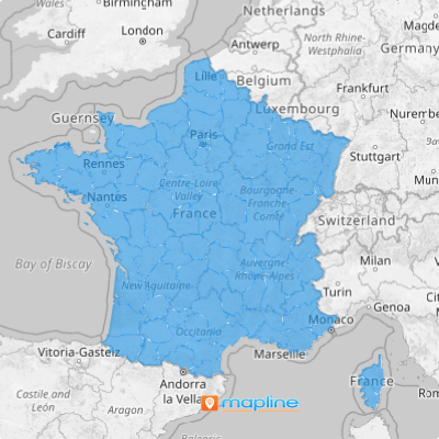
Add France departments to your map in seconds! This type of map offers new insights into market shifts, logistics patterns, and regional trends. By mapping France’s departments, you gain the ability to quickly respond to new opportunities. Expand your reach and uncover game-changing insights in France! Take one bold step to gain a crystal-clear view of sales performance, spot potential risks, and outsmart the competition.
Let’s quickly review how to add French departments to your map so you can optimize your operations and enhance your analytics.
WHAT ARE FRANCE DEPARTMENTS?
France is divided into 96 administrative units called departments. Within these units, there are also 335 arrondissments, or districts. French departments offer a powerful way for brands to perform location and data analysis, transforming how they manage assets and adapt to changing conditions. Leveraging department-level maps empowers you to improve sales, marketing, logistics, and service strategies, and offers clear, actionable insights.
ADD FRANCE DEPARTMENTS
Mapping these departments opens the door to powerful insights. By visualizing these boundaries, you can dive deep into regional demographics, market trends, and consumer behavior.
We weren’t kidding when we said adding French departments to your map only takes a few seconds. First, add a new territory from Mapline’s repository.
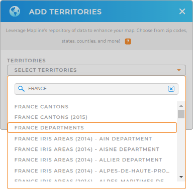
Type FRANCE into the searchbar and select FRANCE DEPARTMENTS. It’s that quick!
There’s just one more quick step, before your map is ready to use.


Pro Tip: Mapline’s worldwide territory repository includes an extensive list of boundaries for France. Enhance your territory analysis as you dive deep and add other territories including France IRIS areas, France cantons, France regions, and France postal codes to explore even more geographic areas.
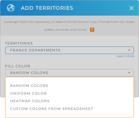
CHOOSE DEPARTMENT COLORS
Enhance the impact of your territory map with custom color styles. This is the perfect way to visualize key data, identify trends, and make informed decisions at a glance.
Just select your desired type of colors, then click OK to finalize your map of French departments.

GET NEW TERRITORY INSIGHTS
There are many ways to reveal valuable insights hidden in your data with Mapline’s powerful capabilities:
- Extract valuable insights with comprehensive territory reports
- Seamlessly incorporate new data in seconds
- Draw custom boundaries to get an in-depth look at the impact of geographic factors on your business


