GERMANY POSTCODES
- Territory Guide
- GERMANY POSTCODES
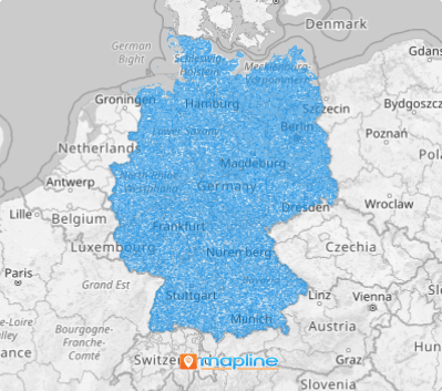
For a more detailed and precise approach to territory analysis, leverage a map of Germany postcodes. This level of spatial analysis empowers you to deepen your market understanding, uncover hidden patterns, and unlock opportunities that might otherwise slip by. Whether you’re optimizing operations or pinpointing the ideal investment location, this tool provides the insights you need to make confident, data-driven decisions. It’s not just about reacting to the market—it’s about anticipating trends and staying ahead of the curve.
Get ready, because postcode-level analysis isn’t just valuable—it’s a game-changer for anyone serious about driving their business forward. Harness these insights and transform them into strategic victories.
WHAT ARE GERMANY POSTCODES?
The German 5-digit postal code database consists of 8699 areas. Germany’s postal code system, introduced on July 1, 1993, is a five-digit structure designed for precision in mail delivery. The system works as follows:
- The first digit indicates the broad area
- The second digit specifies the region within that area
- The last three digits identify the town or a group of delivery districts
The current postal code range in Germany spans from 01067 to 99998. This system ensures efficient sorting and delivery across Germany’s diverse regions.
- 01067, the lowest postal code, corresponds to the historic eastern city of Dresden
- 99998, the highest postal code, is assigned to the central towns of Körner and Weinbergen
Gain a competitive edge with a Germany postcode map! This might be your secret weapon for strategic success. By visualizing the unique potential of each boundary, you can move beyond a one-size-fits-all approach to address the specific needs and opportunities of your target market by postcode area.
ADD GERMANY POSTCODES
Leverage postcode boundaries to allocate your sales force strategically. Imagine having the ability to target high-growth areas with precision! Empower your business with granular insights that drive smarter decisions, enhance efficiency, and propel your success to new heights.
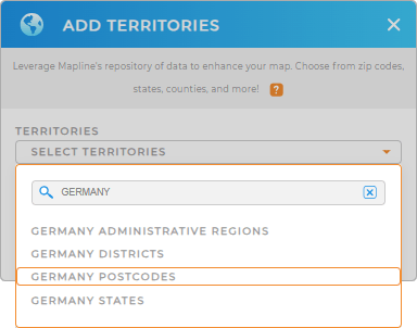
To add a new territory from Mapline’s repository in seconds, utilize the search bar. Type GERMANY and choose GERMANY POSTCODES from the selections.
Woah, that was lightning fast!


Pro Tip: Leverage Mapline’s global territory repository to explore pre-defined territories in Germany including Germany districts, postcodes, Germany regions, and Germany states to help you dig deeper into data and territory analyses.
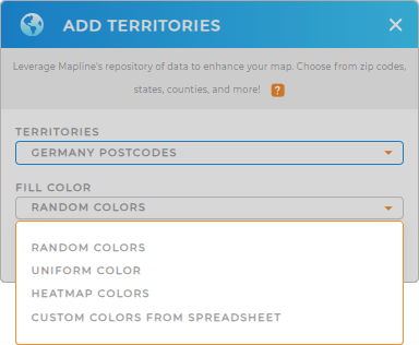
CHOOSE POSTCODE COLORS
Make your map a masterpiece of clarity and impact! You can either choose static or dynamic colors. Static colors help to easily distinguish between different areas, making it effective for presentations on sales assignments. Dynamic colors allow for immediate visual interpretation, helping to guide strategic decisions and identify areas needing attention.
Use both color styles effectively to create a comprehensive visual narrative, empowering you to make data-driven decisions.

GET NEW TERRITORY INSIGHTS
Hone in on new insights as you leverage these powerful capabilities to your analysis:
- Discover valuable information that can enhance operations
- Cut travel time and expenses in half with a dynamic system that seize every opportunity that comes your way
- Keep events, deadlines, and appointments on track by adding a calendar


