GERMANY ADMINISTRATIVE REGIONS
- Territory Guide
- GERMANY ADMINISTRATIVE REGIONS
A map of Germany administrative regions is a smart analytical tool that enables you to make high-impact decisions, adapt swiftly, and propel your business to new heights. Imagine pinpointing precisely where your business can flourish, not through guesswork but by tapping into the nuanced pulse of each community. When you map insights within region boundaries, you can uncover hidden opportunities and insights that can revolutionize your approach to strategy, logistics, and marketing, giving you a competitive edge in every move.
Be empowered to make high-impact decisions to drive your business to new heights. Let’s get this territory added to your map now!
WHAT ARE GERMANY ADMINISTRATIVE REGIONS?
Germany, a vibrant nation in the heart of Europe, is a federation of 16 unique states, each with its own character and rich history. 13 of these states, known as “Free States,” proudly embrace their republican traditions. Together, they are organized into 19 administrative regions, which serve as dynamic hubs for regional governance. These regions, each led by a district president, act as the crucial bridge between state and local governments. Their role is to oversee and streamline decision-making for the diverse urban and rural districts within their borders, ensuring Germany’s regions thrive with a balance of autonomy and cohesion.
When your strategies are tuned to the unique characteristics of each region, you’re not just meeting customer needs—you’re exceeding their expectations! From customizing product offerings and fine-tuning marketing campaigns to optimizing logistics, this precise insight lets you tap into markets with maximum impact. Let’s dive in and explore the transformative power of detailed mapping and how it can elevate your business to new levels of success!
ADD GERMANY REGIONS
Fortify your presence within regional boundaries and quickly capture location insights to help you make data-driven decisions with confidence! Whether it’s tailoring marketing efforts to hyper-local needs or refining your sales strategy, you can never go wrong in region-level mapping.
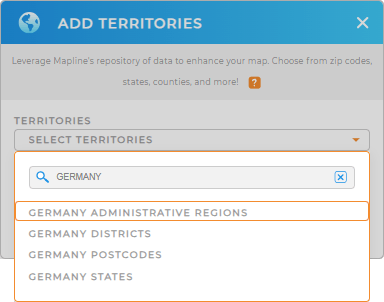
To add a new territory from Mapline’s repository, just type GERMANY in the search bar and select GERMANY ADMINISTRATIVE REGIONS.
Step 1 is done, now let’s go to custom territory styling with colors.


Pro Tip: Mapline’s territory repository aims to help you leverage different regions including Germany administrative regions, Germany states, Germany postcodes, and Germany districts, to help you delve deeper into data and territory analyses.
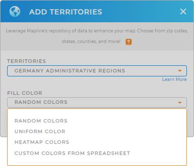
CHOOSE REGION COLORS
Colors are an essential tool for elevating the visual appeal of your map, turning complex data into clear and actionable insights. When you apply unique color styles —whether it’s uniform shades for consistency, heat maps for intensity, random colors for variety, or tailored custom palettes—you bring clarity to your data straight away. This powerful visualization allows you to tap into fresh data insights that are easier to interpret.
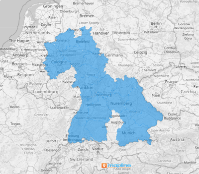
Once you have customized the feel and look of your territory, click OK. Now, you can start analyzing your data on a map of Germany regions.

GET NEW TERRITORY INSIGHTS
There’s a lot more that you can do with your region map! Leverage these powerful capabilities to hone in on new insights:
- Craft cost-efficient delivery plans effortlessly
- Use distinct pin styles for better customer segmentation
- Add a new report and share valuable data insights with your team


