GUATEMALA DEPARTMENTS
- Territory Guide
- GUATEMALA DEPARTMENTS
Want to unlock strategic growth in Guatemala? With Mapline, mapping Guatemala’s department boundaries is the first step toward deeper market understanding and better resource allocation. Each department boundary provides a window into specific regional trends, making it easier to craft data-driven decisions that elevate your bottom line.
Whether you’re developing targeted marketing strategies or managing resources, a map of Guatemala’s departments can reveal critical patterns that drive efficiency and opportunity. Let’s dive into creating your own department map in Mapline and put these insights to work!
WHAT ARE GUATEMALA DEPARTMENTS?
In Guatemala, a department is an administrative region, similar to a state or province, that helps organize governance and local services. The country is divided into 22 departments, each with unique economic and demographic characteristics, from urban centers to agricultural zones. Departments are further divided into municipalities, which serve as smaller local governments within each department.
Mapping Guatemala’s departments offers businesses a powerful way to analyze market trends, locate customer hotspots, and manage logistics efficiently across diverse regions. With Mapline, creating and managing these department boundaries on a map brings your planning and insights to a whole new level.
ADD GUATEMALA DEPARTMENTS
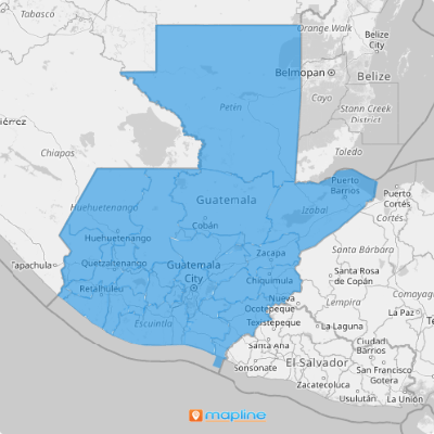
Once your department boundaries are on the map, you’ll see clear geographic areas to analyze customer distribution, optimize delivery routes, and choose the best locations for growth. This sets the foundation to help you identify key areas for resource allocation, streamline distribution, or reduce costs by optimizing travel routes.
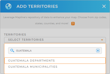
Ready to get started? First, add a new territory from Mapline’s repository. Type GUATEMALA in the searchbar and select GUATEMALA DEPARTMENTS from the list.


Pro Tip: Mapline’s territory repository opens the door to endless opportunities, giving you access to a vast collection of boundaries from countries across the world. If you’re looking to gain a competitive edge, start by exploring Guatemala municipalities and departments—each offering a distinct lens to uncover strategic insights.
CHOOSE DEPARTMENT COLORS
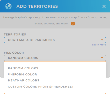
Next, bring your data to life by choosing custom color styles for each department. Select static colors to emphasize specific departments or use dynamic colors to keep map visuals updated alongside your datasets.
Once you’ve chosen your color styling, click OK, and your map of Guatemala departments is ready!
Each department boundary provides unique insights, transforming your map into a powerful, data-driven decision-making tool.

GET NEW TERRITORY INSIGHTS
- Apply labels to transform your map into an informative visual aid
- Calculate driving distances automatically with Mapline Data
- Enhance your analysis by integrating data from other datasets


