GUATEMALA MUNICIPALITIES
- Territory Guide
- GUATEMALA MUNICIPALITIES
Map Guatemala municipalities and get ready to unlock strategic business growth across the country! If your business spans across multiple municipalities and want to take more action to expand across the Guatemala market, mapping municipality boundaries is the best approach. Each municipality boundary tells a story, uncovering regional trends that make smarter decisions effortless. From designing laser-focused marketing strategies to optimizing resource management, these maps reveal game-changing patterns that fuel efficiency and uncover opportunities.
Let’s create your own dynamic municipality map with Mapline and bring your strategies to life!
WHAT ARE GUATEMALA MUNICIPALITIES?
Guatemala, the heart of Central America, stands out as the region’s most populous country, boasting around 340 municipalities. These municipalities are vibrant hubs of local governance, where leaders seek greater autonomy to actively shape their communities’ development. Municipalities take charge in key sectors like business development, public transport, and social services. This dynamic balance of centralized and local responsibilities highlights Guatemala’s commitment to empowering local leaders and fostering progress tailored to each community’s unique needs.
Gaining a deeper understanding of Guatemala’s municipality boundaries can unlock incredible opportunities for your business. Imagine analyzing sales performance across these regions—suddenly, the map becomes a treasure trove of insights. You’ll quickly identify high-performing areas and uncover untapped opportunities you might have missed. Armed with this knowledge, you can refine your sales and marketing strategies to resonate with local markets, ensuring your approach is as precise as it is impactful.
ADD GUATEMALA MUNICIPALITIES
Get ready to revolutionize your approach to location analytics with Mapline! Once you map out municipality boundaries, you’ll unlock a crystal-clear view of geographic areas that transform how you analyze customer distribution, optimize delivery routes, and pinpoint the best locations for growth.
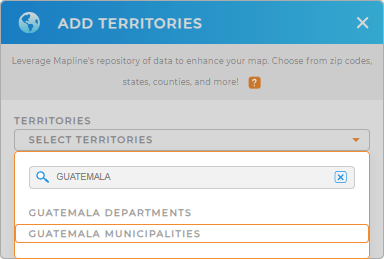
Let’s add a new territory from Mapline’s repository very quickly by typing GUATEMALA to your map and select GUATEMALA MUNICIPALITIES.


Pro Tip: You can create maps with specific geographic boundaries that suit your needs when you leverage Mapline’s global territory repository. Add Guatemala departments and municipalities to your map in seconds to enhance location-driven decision-making.
CHOOSE MUNICIPALITY COLORS
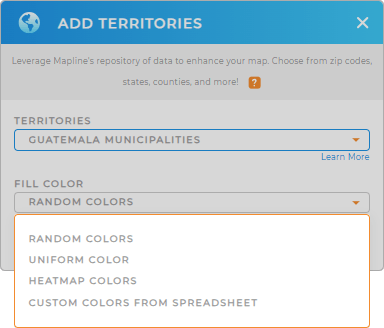
Now it’s time to customize your map of Guatemala’s departments with vibrant color styles to make insights pop. Highlight key areas with static colors or opt for dynamic coloring to keep your visuals in sync with evolving datasets.
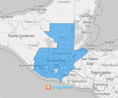
Once you’ve perfected your color styles , click “OK,” and your interactive map is ready to shine. Every municipality boundary becomes a gateway to deeper insights, turning your map into a powerful tool for smart, data-driven decisions.

GET NEW TERRITORY INSIGHTS
Sharpen your decision-making even more when you glean new insights using these powerful capabilities:
- Visualize coverage areas to identify opportunities easily
- Outrank the competition with competitive market analysis
- Build a unified system that automatically collects, stores, and analyze your data


