GUINEA-BISSAU PROVINCES
- Territory Guide
- GUINEA-BISSAU PROVINCES
Stay ahead of the competition by mapping Guinea-Bissau’s provinces and uncovering game-changing insights. With province boundaries offering a broader perspective, you can easily spot patterns, trends, and opportunities on a larger scale. This deeper understanding empowers you to make smarter, strategic decisions and stay at the forefront of your industry.
Discover how easy it is to add Guinea-Bissau provinces to your map in just seconds! This quick setup empowers you to generate actionable insights that can significantly enhance your business strategies. With the ability to visualize province boundaries, you’ll craft your strategies with confidence and precision, ensuring you’re always one step ahead in making informed decisions!
WHAT ARE GUINEA-BISSAU PROVINCES?
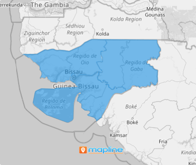
Guinea-Bissau, a lush tropical nation on West Africa’s Atlantic coast, is divided into three main provinces—Leste (East), Norte (North), and Sul (South)—encompassing its eight unique regions. Brands that conduct province-level analysis here can gain powerful insights into the diverse factors influencing their business across these areas. For example, a company seeking to track growth in the Bafatá and Gabu regions can streamline its analysis within the Leste province, enabling targeted, efficient evaluation. This granular approach not only enhances strategic planning but also drives growth and provides a distinct competitive edge in today’s fast-evolving market.
Elevate your analytics game today by diving deeper into the province-level analysis, unlocking valuable insights that can sharpen your business strategy.
ADD GUINEA-BISSAU PROVINCES
Explore in-depth analysis across provincial regions to unlock valuable insights into market dynamics, customer behaviors, and logistical efficiencies. This understanding empowers you to develop robust strategies that position your business ahead of the competition.
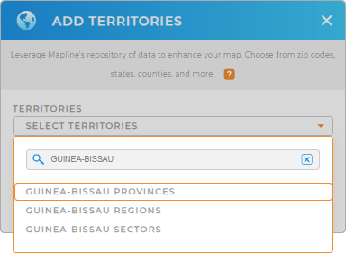
Unlock the potential of your data today as you add a new territory from Mapline’s repository. In the search bar, type GUINEA to trim down the selections, then click GUINEA-BISSAU PROVINCES to add to your map.
Is there any other way easier than that?


Pro Tip: Analyze key metrics and gain new insights to chart territory plans when you access Mapline’s territory repository to add international boundaries to your map including Guinea-Bissau provinces, Guinea-Bissau regions, and Guinea-Bissau sectors.
CHOOSE PROVINCE COLORS
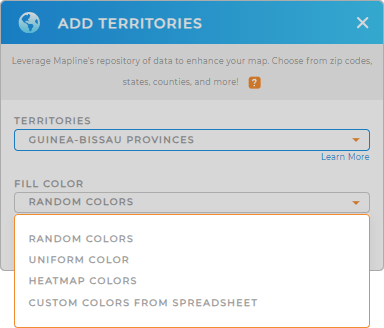
With the right territory added, it’s time to apply fill colors to enhance your map. Colors are an effective visualization technique, helping you distinguish between provinces at a glance. By strategically using colors, you can reveal deeper insights, uncovering spatial patterns, trends, and concentrations within your territories.
Choose a color styling option to guide your analysis and transform your data into a compelling visual narrative, making it easier to spot opportunities and drive informed decision-making.
Click OK to wrap up the process of creating a map of Guinea-Bissau provinces. What’s next?

GET NEW TERRITORY INSIGHTS
Course your strategies in the valuable insights you can dig just by applying these capabilities in your analyses:
- Set up an automated trip planning system in just a few clicks
- Create hyper-local marketing campaigns to win over potential customers
- Narrow down the data displayed to focus on a specific area


