HUNGARY LOCALITIES
- Territory Guide
- HUNGARY LOCALITIES
Map your insights across Hungary localities and gain a powerful bird’s-eye view of regional dynamics. This fresh perspective unlocks new insights that drive smarter strategic decisions and fuel business growth. Whether you’re pinpointing target markets, tracking location-based performance, or boosting operational efficiency, your map becomes an indispensable tool.
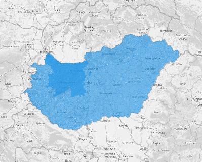
With Mapline, you can create a map of Hungary localities in seconds so you immediately dive deep into the unique characteristics of each locality. Check it out!
WHAT ARE HUNGARY LOCALITIES?
Hungary, a landlocked gem in Central Europe, is a tapestry of localities including cities, towns, and villages woven into 19 vibrant counties. Though small in size, Hungary boasts breathtakingly diverse landscapes and rich natural resources, making it a land of endless potential.
Imagine bringing your data to life with dynamic county-level maps—unlocking hidden trends, revealing untapped opportunities, and empowering real-time decision-making. By diving into locality-level analysis, you can fine-tune strategies to streamline operations, optimize resources, and supercharge your sales and marketing efforts. The result? A smarter, sharper approach that drives growth, efficiency, and long-term success for your business. Hungary’s localities hold the keys—are you ready to unlock them?
ADD HUNGARY LOCALITIES
Add locality boundaries to your map and start uncovering hidden opportunities to make informed decisions. Visualize your data with precision and clarity to transform insights into action and set your business on the path to success.
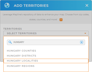
In seconds, you can add a new territory from Mapline’s repository. Just type HUNGARY in the search bar so you can quickly select HUNGARY LOCALITIES.
Convenient, isn’t it?


Pro Tip: Mapline’s extensive repository of territory boundaries empowers you to combine Hungary territories including Hungary counties, Hungary districts, Hungary regions, and localities into your map, paving the way to find the most effective approach for crafting strategies.
CHOOSE LOCALITY COLORS
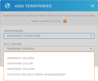
Now, the second step will blow your mind. It’s about applying fill colors for your territory. Whether you want to identify market opportunities, optimize logistics, or analyze customer distribution, Mapline empowers with the best color styling choices that will make an impact to your data visualization.
Once you’re done configuring your settings, click OK. Start mapping today and unlock the insights you need to elevate your strategies and achieve your goals with precision.

GET NEW TERRITORY INSIGHTS
Apply these awesome capabilities as you analyze your data on a map of Hungary localities:
- Run advanced data calculations to discover hidden patterns and trends
- View territory report to get more insights to make data-driven decisions
- Spot flourishing market opportunities by adding demographic data


