HUNGARY REGIONS
- Territory Guide
- HUNGARY REGIONS
Integrate Hungary regions into your map to unlock timely insights into demographic patterns, identify market potentials, and much more. With this tailored regional mapping, you can craft strategies that resonate with local preferences and needs, leading to more effective engagement. This approach enables you to adapt your tactics to regional distinctions, making your business more agile and better positioned to capture opportunities within each market segment. Whether you’re looking to refine a start-up strategy or assess key factors for expansion, a region-based map provides a clear view of geographic and market-specific elements crucial for informed decision-making.
Create a region-specific territory map today with just a few clicks!
WHAT ARE HUNGARY REGIONS?
Hungary’s seven statistical regions, established in 1999, group together its 19 counties and the capital city, offering a valuable framework for high-level analysis. For businesses looking to monitor operations across multiple counties, a region-level analysis provides a clear snapshot of performance, helping you quickly identify both successful areas and those needing improvement. This broader view makes it easier to assess operational trends and make strategic adjustments, empowering you to refine business strategies for optimal impact across Hungary’s diverse regions.
Leverage the regional insights you can gain to refine your market planning, improve customer service, and assess site suitability.
ADD HUNGARY REGIONS TO MAP
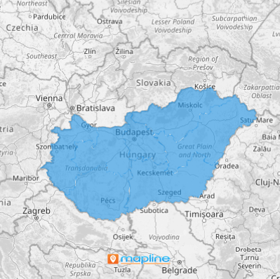
In just a few seconds, get ready to create a map of Hungary regions tailored to your business needs! This map provides insights into sales territories and coverage areas which will empower your business to operate more effectively in the Hungarian market.
Here in Mapline, we make it so much easier for you to add a new territory from Mapline’s repository so you can focus more on data and territory analysis.
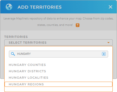
Type HUNGARY into the search bar and select HUNGARY REGIONS from the drop-down menu.
Easy, right? Now, let’s move on to Step 2.


Pro Tip: Explore Mapline’s territory repository to discover territories for Hungary – Hungary counties, Hungary districts, regions, and Hungary localities. Customized territory maps elevate your analytics by providing insights that are closely aligned with your market’s unique characteristics.
CHOOSE REGION COLORS
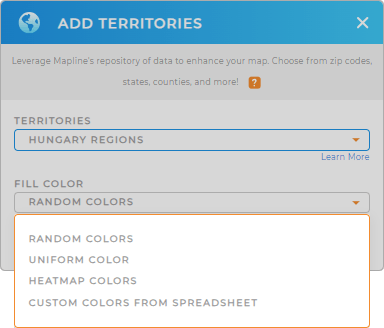
Step 2 is about choosing the colors for your territory. Gain new insights from your map of Hungary regions the moment you incorporate them with custom colors. They serve as a visual guide so you can interpret what your data is saying in a flash.
To choose the right colors for your territory, select the type of color styling from the selections given, then click OK.
With your Hungary regions map ready to go, now you can start your analysis.

GET NEW TERRITORY INSIGHTS
Now, here are some capabilities that will surely help you chart a course for deeper analysis:
- Turn your map pins into routes in seconds
- Generate pins from your spreadsheet data in just a few seconds
- Create a robust delivery confirmation system giving you the control and transparency your operation demands


