ICELAND MUNICIPALITIES
- Territory Guide
- ICELAND MUNICIPALITIES
Gain a sharper edge in understanding your market as you delve into analysis on a map of Iceland municipalities. Mapping with municipality boundaries brings a fresh level of clarity, uncovering insights that go beyond the surface. Instantly reveal hidden connections between geography and performance, empowering you to refine strategies, streamline operations, and drive efficiency like never before. With a sharper, more detailed perspective, you’re equipped to make smarter moves and stay ahead of the competition! Whether you want to refine your marketing strategy to hyper-local needs, optimize your logistics, or streamline your operations, leveraging a municipality map empowers you to make data-driven decisions with confidence.
Create a map of Iceland municipalities today and align your business strategies to the next with the unique dynamics of each area, allowing you to gain a competitive edge.
WHAT ARE ICELAND MUNICIPALITIES?
The municipalities of Iceland are local administrative regions responsible for delivering essential services to their residents, including kindergartens, elementary schools, waste management, social services, public housing, and public transportation. The autonomy of municipalities in managing their affairs is safeguarded by the Icelandic constitution, ensuring they have significant control over local governance. There are currently 64 municipalities in Iceland.
Successful brands recognize the power of mapping Iceland municipalities for strategic decision-making. Leveraging a municipality map in analytics allows them to have a clear visualization of their customer base that helps identify market potential. Embrace this approach as it will help you achieve remarkable results in today’s competitive landscape.
ADD ICELAND MUNICIPALITIES
A detailed map of municipalities offers the clarity to strategically direct your efforts and enables you to focus on areas that require more attention. By understanding the geographical landscape, you can optimize processes, improve logistics, and drive better results for your brand.
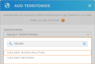
Add a new territory from Mapline’s repository to start this focused approach. Just type ICELAND into the search bar and select ICELAND MUNICIPALITIES to add to your map.
You’re halfway through getting the most out of your municipality map. Now, let’s turn your attention to the last step.


Pro Tip: Add Iceland regions and municipalities to your map in seconds! Leverage Mapline’s extensive list of territory boundaries to capture additional ideas that will help you sculpt strategies to propel your business forward.
CHOOSE MUNICIPALITY COLORS
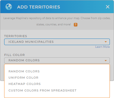
For visual clarity, apply colors to your territory. Colors play a crucial role in turning complex data into easy-to-understand visualization. Mapline provides static or dynamic colors. You can apply static colors to differentiate the municipality boundaries at a glance. Or apply dynamic colors to identify patterns and trends quickly. Using this approach helps you identify high or low-performing areas so you can pivot your strategies right away!
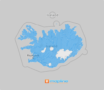
Apply the best territory color styles that match your level of analysis. Lastly, click OK and watch your map of Iceland municipalities transform into a powerful visualization ready to be gleaned with valuable insights.

GET NEW TERRITORY INSIGHTS
With your new map in tow, explore these advanced capabilities to reap more location insights for making data-driven decisions:
- Emphasize competitor locations using unique pin styles
- Run an extensive market analysis in minutes
- Identify low performing stores and transform your strategies accordingly


