INDONESIA PROVINCES
- Territory Guide
- INDONESIA PROVINCES
Add Indonesia provinces to your maps to create a powerhouse of insights for your business! A clear visual representation of all the provinces in Indonesia is vital for optimizing your strategies and staying ahead of the competition. Easily pinpoint areas with the highest potential and streamline your routing once you’ve analyzed your data within the provinces of Indonesia.
Start enhancing your sales strategies today by mapping Indonesia’s provinces. Creating a map takes less than a minute, allowing you to focus more on data analysis. Check it out!
WHAT ARE INDONESIA PROVINCES?
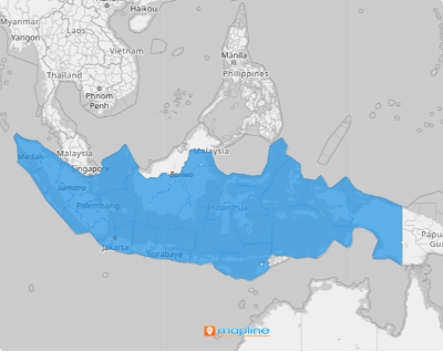
Indonesia, a Southeast Asian country, is divided into 34 provinces. Five of these provinces have Special Administrative status. They are further divided into regencies, districts, cities, villages, communities, and neighborhood groups.
Mapping the province boundaries can amplify your sales strategies, helping you achieve the best decisions for more targeted strategies, resource allocation, identifying opportunities, enhanced communication, performance monitoring, and more!
ADD INDONESIA PROVINCES
You’re moments away from data-informed business decisions that set you apart from the competition! Let’s quickly add Indonesia’s provinces to your map and unveil new insights about your sales and operations.
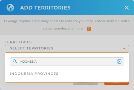
First, add a new territory from Mapline’s repository. Type INDONESIA into the search bar and select INDONESIA PROVINCES.
There’s just one more quick step, and you’re done creating your territory map.


Pro Tip: Mapline’s extensive repository of territory boundaries allows you to add precise regional divisions to your map. Add different regions to compare and contrast different insights.
ADD PROVINCE COLORS
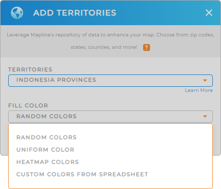
Color-code your map of Indonesia provinces to pinpoint top-performing and underperforming areas at a glance. Colors are a powerful way to highlight key differences, such as region boundaries or sales performance across regions.
To add custom colors to your map, simply choose your preferred type of color styling, then click OK.
Woah! You just trimmed down the time it takes to assessment your data. How cool is that?

GET NEW TERRITORY INSIGHTS
With your map of Indonesia provinces, be empowered to unlock more valuable insights by using these powerful capabilities:
- Filter your data to hone in on key audience insights within each province
- Optimize your sales routes for increased efficiency and reduced travel time
- Run Mapline Data calculations to uncover sales trends hidden in your data


