IRAN PROVINCES
- Territory Guide
- IRAN PROVINCES
Add Iran provinces to your maps and transform your business challenges into opportunities! By mapping Iran’s provinces, you can pinpoint areas where your business is in demand, enabling you to optimize operations for maximum efficiency. By mapping province boundaries, you can uncover the unique traits and vibrant dynamics that define your target market. With this clarity, you can craft marketing strategies that feel tailor-made, speaking directly to the hearts and minds of your audience.
Incorporate Iran’s provincal boundaries into your analyitics strategy and get the insights you need to optimize logistics, improve operational efficiency, and drive better business outcomes. Here’s how.
WHAT ARE IRAN PROVINCES?
Iran, formerly known as Persia, is located in Western Asia. Within Iran, there are 31 provinces or ostân, each of which is goverened by a local center, typically the largest local city. The province with the largest population is Tehran, with a population of over 13.5 MIL.
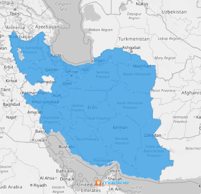
Mapping Iran’s provinces gives you better insight into your business coverage, sales trends, and how provincial boundaries impact your operations. Use this map as a game plan to focus on areas that need the most attention. What a powerful way to gain a comprehensive overview of your business!
ADD IRAN PROVINCES
Add Iran’s provinces to your map in a flash!
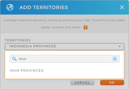
Simply add a new territory from Mapline’s repository, type IRAN into the searchbar, and select IRAN PROVINCES.
This process quickly integrates provincial boundaries into your mapping strategy, providing a comprehensive view of your operational landscape.


Pro Tip: With Mapline’s comprehensive database of territory boundaries, you can seamlessly add regions from various countries to your map, broadening your logistical capabilities globally.
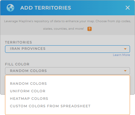
CHOOSE PROVINCE COLORS
Color-coding Iran’s provinces enhances data visualization, enabling quick identification of performance metrics and regional trends.
Choose your preferred color styles to highlight sales territories, logistics routes, or service areas effectively. When you’re done, click OK.
This visual distinction facilitates better decision-making and operational optimization.

GET NEW TERRITORY INSIGHTS
Dive deeper into territory insights with Mapline’s powerful analytics toolkit. Here are some incredible ways to learn more about your audience and business:
- Add a new chart to highlight KPIs such as performance or spending
- Generate customize reports to analyze key metrics within each province
- Optimize fleet management across provinces by tracking vehicle usage and maintenance needs


