IRAQ DISTRICTS
- Territory Guide
- IRAQ DISTRICTS
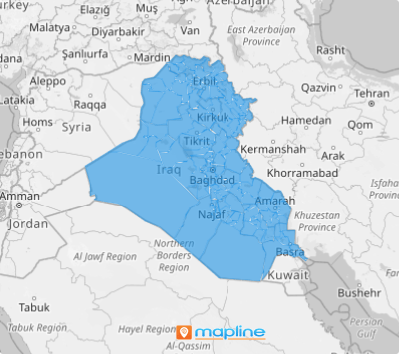
Gain a competitive edge and unlock deeper market insights with a map of Iraq districts. By analyzing your market against district boundaries, you gain the clarity to uncover trends and connections beyond the surface-level analysis. This detailed view allows you to align your strategies with the unique dynamics of each district, enhancing your operational efficiency and business impact.
Whether you’re refining your marketing strategies to meet hyper-local needs, optimizing logistics, or streamlining day-to-day operations, leveraging a district map empowers you to make confident, data-driven decisions. Create a map of Iraq’s districts today and take your business strategies to the next level.
WHAT ARE IRAQ DISTRICTS?
Iraq, a key nation in West Asia and a cornerstone of the Middle East, is divided into 18 governorates, further segmented into 120 districts. These districts are more than administrative boundaries—they’re gateways to unlocking strategic insights for your brand.
Whether managing multiple locations or optimizing operations, mapping district-level data transforms complexity into clarity. From streamlining logistics to refining marketing strategies and enhancing distribution networks, this granular view empowers you to make smarter, data-driven decisions with ease. In Iraq’s dynamic landscape, district-level mapping is your key to staying ahead.
ADD IRAQ DISTRICTS
Addding territories to your map empowers you to visualize, analyze, and adapt with precision to stay ahead of the competition and maximize your growth potential.
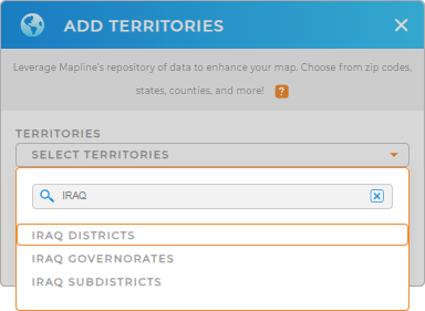
Here in Mapline, you can seamlessly add a new territory from Mapline’s Repository. Just type IRAQ in the search bar, and click to add IRAQ DISTRICTS to your map.
How easy can it get?


Pro Tip: Access Mapline’s global territory repository to add territories in Iraq including districts, Iraq governorates, and Iraq subdistricts to your map. Compare and contrast these boundaries against your data to capture valuable insights to derive smart decisions.
CHOOSE DISTRICT COLORS
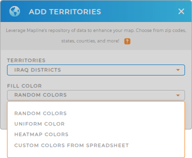
The last part is about applying territory colors. Whether it’s refining your marketing approach or optimizing resource allocation, color-coded territories provide the clarity you need to stay ahead.
Mapline provides static colors so you can assign status-based distinctions, providing a clear and instant visual breakdown of your territories. You can also take it up a notch with dynamic colors that adapt in real-time, directly tied to your data metrics for a deeper, more insightful analysis.
Transform your map into a vivid narrative by customizing color styles that align with your goals.

GET NEW TERRITORY INSIGHTS
What else can you do with your map of Iraq districts? Tons! Add these capabilities and see for yourself how your map can be a real game-changer:
- Apply network coverage to pinpoint unseen opportunities
- Create optimized routes for the utmost efficiency
- Merge territories to find the best version for your analysis


