IRAQ GOVERNORATES
- Territory Guide
- IRAQ GOVERNORATES
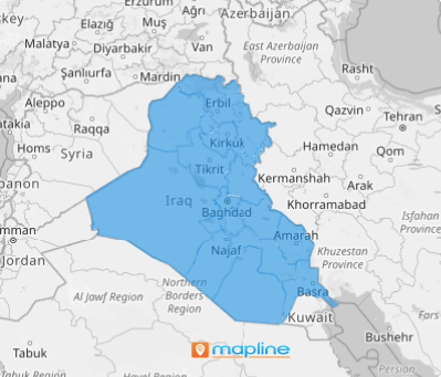
A map of Iraq governorates is a robust tool for improving business operations, especially for identifying and capitalizing on concentrated areas of activity, optimizing deliveries, and exploring untapped markets. Because this map has clearly defined boundaries, it offers the strategic advantage of territorial intelligence and provides the visual clarity needed to optimize business operations in sales, logistics, and marketing—leading to more targeted, efficient, and profitable strategies. Visualize your team’s performance within these administrative levels to spot growth opportunities, streamline operations, and penetrate new markets.
Leverage an Iraq governorate map to acquire a data-driven foundation for refining strategies, optimizing operations, and focusing your efforts where they will yield the best results.
WHAT ARE IRAQ GOVERNORATES?
Iraq is divided into 18 recognized governorates, also referred to as provinces, and one partially recognized governorate. These boundaries serve as the primary administrative divisions in the country, with each having its own local government to manage regional affairs. These local governments are responsible for managing regional affairs, including economic development, infrastructure, security, education, and healthcare within their territories.
Mapping Iraq’s governorates produces immense value for different industries, especially those managing numerous locations, such as the petroleum sector. By visualizing governorate-level data, it becomes easier to manage logistics, marketing, distribution, and more.
ADD IRAQ GOVERNORATES
Let’s start adding the governorate boundaries to your map so you can start visualizing key regions to identify and tailor your strategies to potential markets. This is the fastest approach to defining your areas of focus so you can gain accurate representations of your data by area, streamline your process, and make informed decisions for your brand’s performance across the governorate level.
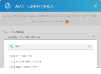
Start by clicking the ADD button on the left side of your map. Then add a new territory from Mapline’s repository. Type IRAQ in the search bar and select IRAQ GOVERNORATES.


Pro Tip: Get access to Mapline’s worldwide territory repository to add territory boundaries including Iraq governorates, Iraq districts, and Iraq subdistricts to your map. Compare different boundaries against your data to capture more valuable insights to add to your strategies.
CHOOSE GOVERNORATE COLORS
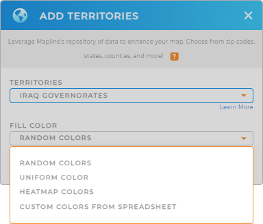
Now, it’s time to apply a fill color. Adding colors to your territory is an enormous help to visualize data connections and patterns at a glance. Apply distinct colors to quickly assess potentials and opportunities, enhancing your decision-making prowess that drives success.
Choose the type of colors that you need for your current data analysis. For example, if you want to show the distinction between territories at a glance, you may want to apply random colors. If you want to visualize the density of your data, you can apply heat map colors. Click OK after configuring the settings.
Now that you have created a map of Iraq governorates, what’s next?

GET NEW TERRITORY INSIGHTS
Optimize your business operations as you leverage these powerful capabilities
- Create a dynamic powerhouse to keep events, deadlines, and appointments on track
- Generate detailed maps of customer locations and track deliveries in real time
- Identify inactive customers and craft hyper-focus strategies that match their needs


