ISRAEL DISTRICTS
- Territory Guide
- ISRAEL DISTRICTS
Create a map of Israel districts and make it a well of location information and insights for your overall business operation. Ignite unstoppable growth and achieve lasting success! With sharp geographic insights at your fingertips, you can pinpoint high-potential markets, supercharge resource allocation, and craft marketing campaigns that hit harder and reach further. By visualizing how your business perform on a district territory map, you‘ll be able to tap key insights that allow you to see potential target areas for business expansion.
Ready to boost your business with actionable insights? Hold tight as we take you on a quick ride of creating a district territory map in just two steps!
WHAT ARE ISRAEL DISTRICTS?
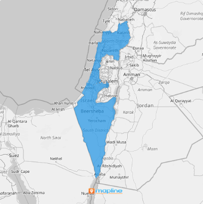
Israel is located in the Middle East. Israel is divided into six main administrative districts known as “mekhozot.”
Leveraging a map of Israel districts helps you understand market demands by district and optimize your logistics operations accordingly. Mapping these districts allows you to laser-focus your attention on high-traffic areas and streamline your operations. The district-level analysis enables you to effectively improve your service delivery and attain customer loyalty and longer market reach.
ADD ISRAEL DISTRICTS
With district boundaries viewable on your map, you can draft business plans that are tailor-fit to the needs of your existing customers and new markets. A district-level analysis leads to quickly analyzing trends per region and optimizing routes to deliver your products and services more efficiently.
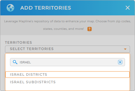
Highten the visibility of your business performance for each region when you take the first step. That’s to add a new territory from Mapline’s repository. Type ISRAEL into the search bar, and select ISRAEL DISTRICTS.
We’re done with Step 1. Easy, right? Watch as we take your attention to Step 2.


Pro Tip: If your business expands globally, leverage Mapline’s extensive repository of territory boundaries including Israel districts and Israel sub-districts. Explore different territories to discover the best territory management for your business.
CHOOSE DISTRICT COLORS
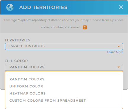
For a more effective data visualization, the second and last step is crucial. Configure your territory color settings. A color-coded map significantly enhances insights to make regional trends and patterns more identifiable. Custom-color your district map of Israel with static colors to distinguish district boundaries or assigned territories per sales rep at a glance. If you want to transform sales figures or other metrics into visually informative color-coded territories, apply dynamic colors.
Choose the best color styles for your district territory. Once you have configured the type of colors applicable to your analysis, hit OK.
Now, your powerful territory map of Israel districts is ready for deeper analytics!

GET NEW TERRITORY INSIGHTS
Now, turn your attention to these advanced capabilities to unlock more valuable insights:
- Filter your data to identify districts with the highest delivery delays and implement solutions right away
- Optimize your inventory distribution when you track product demand variations across different districts
- Enhance customer satisfaction when you analyze feedback and take them constructively


