ITALY REGIONS
- Territory Guide
- ITALY REGIONS
Gain a competitive edge by integrating a map of Italy regions into your analysis. Unlock a wealth of strategic opportunities as you visualize insights within these boundaries, enabling you to fine-tune logistics and supply chain operations with unmatched precision. Imagine effortlessly mapping the most efficient routes, identifying optimal locations for distribution centers, and crafting delivery zones that perfectly align with each region’s unique landscape. This level of insight empowers you to streamline operations, minimize costs, and maximize efficiency like never before.
With Italy’s regional map as your secret weapon, you’re not just managing your business—you’re positioning it for unparalleled success. Get ready to lead the market with confidence!
WHAT ARE ITALY REGIONS?
Italy, located in Southern and Western Europe, is a stunningly diverse country known for its distinctive geography and rich history. The country features a peninsula stretching into the Mediterranean Sea, bordered by the majestic Alps to the north. It also boasts nearly 800 islands, including the prominent Sicily and Sardinia. It is divided into 20 regions, serving as the first-level administrative divisions of the country. Five of these regions—Sicily, Sardinia, Aosta Valley, Trentino-Alto Adige/Südtirol, and Friuli-Venezia Giulia—enjoy special autonomous status, allowing them to enact legislation on specific matters beyond the authority of other regions. This system reflects Italy’s commitment to balancing centralized governance with regional autonomy, ensuring that the country’s diverse cultural and geographic characteristics are effectively managed.
Start analyzing at the region level and be wowed as you watch your map transform into a powerful tool for insights that drive smarter logistics and supply chain decisions.
ADD ITALY REGIONS
A clear visualization of region boundaries unlocks powerful opportunities for your logistics and supply chain operations. Imagine easily pinpointing the perfect locations for warehouses and distribution centers—strategically placed near key customer areas and transportation hubs. This intuitive approach allows you to optimize routes, reduce transit times, and elevate your operational efficiency, all while staying ahead of the competition.
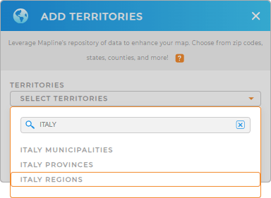
Visualize smarter, act faster, and achieve more! What more can you ask for? Let’s add a new territory from Mapline’s repository now! Type ITALY in the search bar and select ITALY REGIONS to add to your map.


Pro Tip: Access Mapline’s territory repository to add territories in Italy including Italy provinces, regions, and Italy municipalities, to your map in seconds. With Mapline, you can unlock untapped potential, dominate your market, and achieve unmatched success across Italy like never before.
CHOOSE REGION COLORS
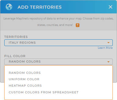
Now, let’s create a more impactful map visualization by adding colors. Apply custom colors to highlight regions to identify areas for optimization. Or assign distinct colors to territories managed by different sales reps for clear accountability and tracking. You can also apply heat map colors to create stunning, data-driven visuals that reveal density patterns around your pins, offering invaluable insights.
Make your map as dynamic as your data. Choose your color styles , and let the insights flow!
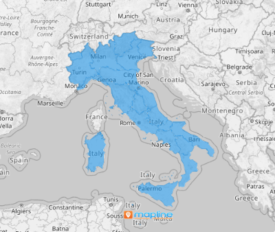
Lastly, hit OK to finish the process of creating a map of Italy regions.

GET NEW TERRITORY INSIGHTS
Unveil more insights as you apply these advanced capabilities in your analysis:
- Plot smart sales routes in seconds
- Understand your data behind map layers in folder report
- Visualize data density within region boundaries


