KOSOVO DISTRICTS
- Territory Guide
- KOSOVO DISTRICTS
When you visualize your business perspective on a map of Kosovo districts, something powerful happens. You gain the ability to see what’s coming—to anticipate challenges before they even happen. District boundaries give you a deeper, more precise understanding of the markets you’re working in. This level of detail isn’t just about numbers; it’s about customers with real needs. By tapping into this granular insight, you can adapt your strategies to align with hyper-local demands. When you align your business to the pulse of the local market, you don’t just operate—you thrive!
Here’s the best part: adding district boundaries to your map is fast and efficient. Let’s add these to your map in seconds!
WHAT ARE KOSOVO DISTRICTS?
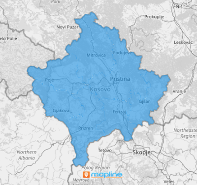
Kosovo, a landlocked country in Southeast Europe, is divided into seven districts, which serve as the basic administrative units. These districts are crucial in shaping local governance, as they represent the only level of power in managing local affairs, making them key players in driving Kosovo’s continued development and progress.
Visualizing insights within district boundaries is a game-changer in developing business strategies —whether you’re working toward short-term wins or long-term impact. By overlaying district boundaries on a map, you can quickly visualize the full landscape, giving you the clarity to design strategies that are grounded in local realities. With just a few clicks, be empowered with a powerful visual tool that makes your planning and decision-making crystal clear!
ADD KOSOVO DISTRICTS
Adding Kosovo districts to your map gives you a detailed view of the landscape, enabling you to make smarter and more strategic choices. With insights at the district level, you can anticipate trends, optimize resources, and tailor your strategies to drive real impact where it matters most.
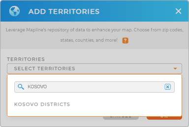
In just a few seconds you can add a new territory from Mapline’s repository! Type KOSOVO in the search bar to lead you directly to KOSOVO DISTRICTS.
We’re almost done – let’s go to the last step.


Pro Tip: Integrate different regional boundaries into your map when you access Mapline’s repository. It houses a vast list of territories from countries worldwide including Kosovo districts. Be empowered to collaborate and understand your data within these boundaries to gain location-based insights that influence and transform your business.
CHOOSE DISTRICT COLORS
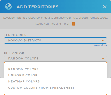
Unlock the power of your district territory map as you apply colors and watch your decision-making soar to new heights. Apply static colors to help make your presentations come alive. Apply dynamic colors to distinguish areas that need attention at a glance.
Whether it’s a shift in customer behavior or untapped market potential, choosing the best color styles ensures that critical insights don’t go unnoticed, empowering you to take action and fine-tune your strategy where it matters most.
Configure your settings and click OK. Wow! You’ve just turned your map of Kosovo into a powerful visual tool that helps you to instantly spot patterns, trends, and outliers with ease.

GET NEW TERRITORY INSIGHTS
Now, apply these powerful capabilities to quicken your data analysis on your map of Kosovo districts:
- Apply powerful automations that boost communication
- Visualize trends and patterns in your data
- Customize the appearance of your territory when marking sales regions


