LITHUANIA COUNTIES
- Territory Guide
- LITHUANIA COUNTIES
If you’re looking to supercharge your competitive edge, it’s time to bring Lithuania counties into your map. This isn’t just about expanding your geographic reach—it’s about unlocking a treasure trove of insights that can transform your entire strategy. By integrating Lithuania’s counties, you’ll be able to pinpoint market trends with laser accuracy, understand customer behavior at a granular level, and fine-tune your operational efficiencies like never before. This map gives you the power to see where opportunities are hiding and how you can swoop in to capitalize on them.
By mapping out these counties, you’re not just gathering data; you’re setting the stage for a major competitive boost. Dive into those insights and watch how they propel your business forward!
WHAT ARE LITHUANIA COUNTIES?
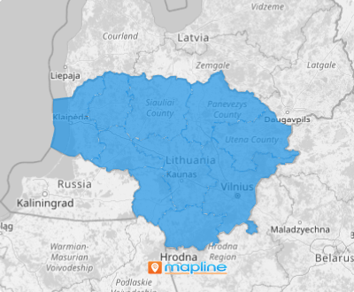
Lithuania might be a small European gem, but with its 10 counties, it’s a land of big opportunities. Each county plays a crucial role in ensuring that municipalities stick to Lithuanian laws and manage essential services like hospitals and healthcare facilities.
Now, imagine having a clear, detailed map of these counties at your fingertips. This isn’t just about having a visual aid; it’s your gateway to uncovering regional trends and spotting opportunities that others might miss. When you can see these counties mapped out, you gain the power to tailor your business development strategies with pinpoint accuracy. This map isn’t just a tool; it’s your strategic advantage in understanding and navigating your data within Lithuania’s complex landscape. So, let’s get those counties on the map and watch your business strategies come to life!
ADD LITHUANIA COUNTIES
By visualizing the county boundaries on your map, you can easily develop tailored marketing campaigns, identify customer distribution, and analyze sales performance.
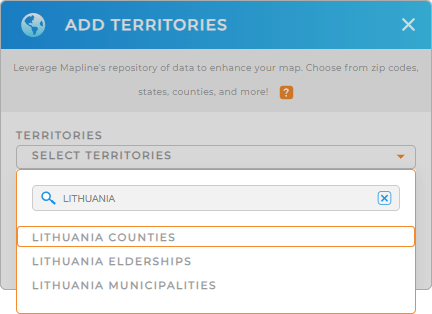
The first step is to add a new territory from Mapline’s repository. It can be accessed when you click the ADD button on the left side of your map. Then, type LITHUANIA into the search bar, and select LITHUANIA COUNTIES.
We’re halfway there. Now let’s go to the last step.


Pro Tip: You can access Lithuania boundaries in Mapline’s Repository. It includes Lithuania counties, Lithuania elderships, and Lithuania municipalities. Find the best approach to your territory analysis as you add different regions and create territory maps.
CHOOSE COUNTY COLORS
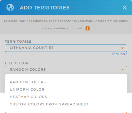
Your county map can be more powerful when you apply colors. By leveraging a color-coded map, you gather rich data insights that lead you to make smarter investment decisions and drive significant ROIs.
How awesome is that? Just choose a suitable type of colors for your territories.
Use different colors to represent sales performance and competitor activity. Easily apply static colors for a visually attractive custom-colored territory map. On the other hand, choose dynamic colors if you want your map to be a true data powerhouse!
Once you click OK, you have finished creating your map of Lithuania counties.

GET NEW TERRITORY INSIGHTS
Achieve a new level of data analysis when you apply these advanced capabilities to your map of Lithuania counties:
- Generate intelligent forecasts with market demographics
- Combine territories on your map to make adjustments on territory assignments
- Get automatic calculation of drivers required, driving distance, or hours spent driving with advanced routing


