LITHUANIA MUNICIPALITIES
- Territory Guide
- LITHUANIA MUNICIPALITIES
Map out Lithuania municipalities to reveal local dynamics essential for informed decision-making. This municipality-level analysis is so impactful that many brands leverage it to uncover market trends they never knew existed. Imagine having the powerful ability to see through your target markets and easily spot opportunities to advance your business! Whether you’re exploring factors to refine your marketing strategies, understand consumer purchasing behavior, or optimize distribution networks, this level of analysis elevates your analytic capabilities, providing the insights needed to drive strategic decisions.
Let’s cut the chase and add these administrative boundaries to your map now!
WHAT ARE LITHUANIA MUNICIPALITIES?
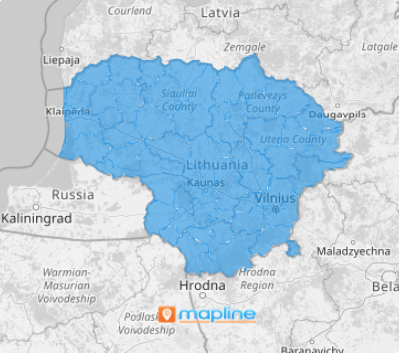
Lithuania, one of the three Baltic states nestled along the eastern shore of the Baltic Sea, is organized into 60 municipalities. These municipalities are vital administrative units that play a crucial role across multiple business functions. This local-level insight empowers businesses to navigate the unique demands of each area effectively, ensuring strategies are both targeted and responsive to regional needs.
For example, if you’re managing a sales team, this map can help you quickly identify high-performing areas, allowing you to deepen customer relationships and focus resources in key regions. This approach transforms regional data into actionable insights, driving targeted, impactful growth.
ADD LITHUANIA MUNICIPALITIES
Leverage a map of Lithuania municipalities to gain valuable insights into regional sales performance, customer behavior, and market dynamics. Applying these insights can help you craft custom-tailored marketing and sales strategies to meet the specific demands of each region. This strategic approach ensures you’re always one step ahead of the competition!
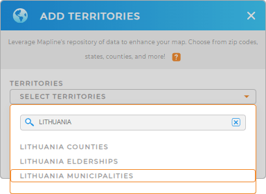
Adding a new territory from Mapline’s repository to your map is so easy you only need to type LITHUANIA in the search bar and select LITHUANIA MUNICIPALITIES.
With the right territory in place, let’s head over to applying territory colors.


Pro Tip: Mapline’s extensive repository of territory boundaries allows you to integrate regions from numerous countries into your map to broaden your global operational reach. Explore different territories, including Lithuania counties, Lithuania municipalities, and Lithuania elderships, to get those territory insights for optimizing operations.
CHOOSE MUNICIPALITY COLORS
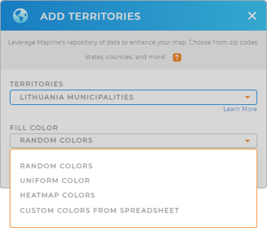
Utilizing territory colors is an effective way to identify concentrations within municipalities and spot spatial patterns and trends at a glance, making it easier to act on your insights and refine your strategies.
Mapline offers a variety of color styling options, each designed to serve a unique purpose in data analytics. These styles allow you to present your data effectively, depending on the context and the specific insights you’re aiming to uncover. Select the best color styles and enhance the clarity and impact of your data visualization in a flash!

GET NEW TERRITORY INSIGHTS
With these powerful capabilities applied to your analyses, you can refine your business strategies even more:
- Optimize a unified system to automatically collects, stores, and analyze your data
- Manage each municipality when you customize reports
- Segment your data to create targeted marketing campaigns


