LONDON WARDS
- Territory Guide
- LONDON WARDS
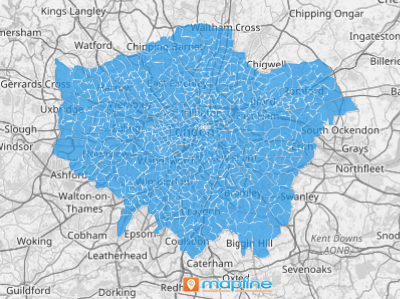
Add London wards to your Mapline map and dive into new insights about your audience and brand. This is a fantastic way to get a high-level overview of your business, spot trends, and drive informed decision-making.
For instance, imagine you’re a logistics manager seeking to streamline delivery operations across London. This type of territory map empowers you to visualize distribution patterns, identify optimal delivery routes, and enhance operational efficiency.
Check it out!
WHAT ARE LONDON WARDS?
The city of London, England’s capital, is divided into 25 wards, serving as electoral subdivisions within the city. Despite their relatively small size, these wards are self-governing units with significant administrative and electoral importance.
A territory map of this kind can be a huge asset to a brand. A logistics manager, for example, can leverage this map to optimize delivery routes, minimize transportation costs, and ensure timely deliveries to customers across various ward communities.
ADD LONDON WARDS
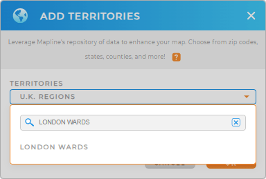
Add London wards to your Mapline map in seconds! First, add a new territory from Mapline’s repository, then type LONDON in the search bar. Select LONDON WARDS, and you’re all set.
It’s never been easier to map the precise territory boundaries you need!


Pro Tip: In addition to London wards, explore other territories available in Mapline’s Repository, such as London boroughs, U.K. regions, and U.K. postcode areas. These additional territories offer comprehensive insights for various business and operational needs.
ADD WARD COLORS
Enhance the visual appeal and analytical power of your map by incorporating vibrant colors into territory boundaries. Assigning colors to ward boundaries not only highlights geographical patterns but also aids in informed decision-making.
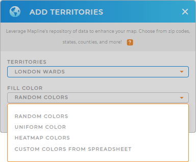
Choose from random, uniform, heatmap, or custom colors. When you’ve selected the color style you need, click OK.

GET NEW TERRITORY INSIGHTS
Unlock the full potential of your territory map with Mapline’s advanced features.
- Import data seamlessly for in-depth analysis
- Plan community visits with optimized routing solutions
- Foster team collaboration by sharing your map with colleagues
With Mapline, you get more than a map–you get access to a dynamic solution for strategic decision-making and operational excellence!


