MADAGASCAR REGIONS
- Territory Guide
- MADAGASCAR REGIONS
Got a minute? Because that’s all it takes to add Madagascar regions to your map! Here at Mapline, you can cut back a significant amount of time adding territories to your map so you can focus more on what really matters – analyzing your strategies on a territory map! Imagine having the ability to have a bird’s eye view of regional dynamics, empowering you to tailor your strategies for specific areas.
Start visualizing your perspectives within region boundaries and capture countless insights to help improve your business operations. Let’s start now!
WHAT ARE MADAGASCAR REGIONS?
Madagascar is a fascinating island nation located off the southeastern coast of Africa. It is a unique blend of natural beauty, cultural richness, and ecological significance, making it a vital area for conservation and a fascinating place to explore. The country is divided into six provinces, which are further subdivided into regions, each with its own unique characteristics and significance. Understanding these regions is essential for grasping Madagascar’s cultural richness, economic activities, and environmental challenges.
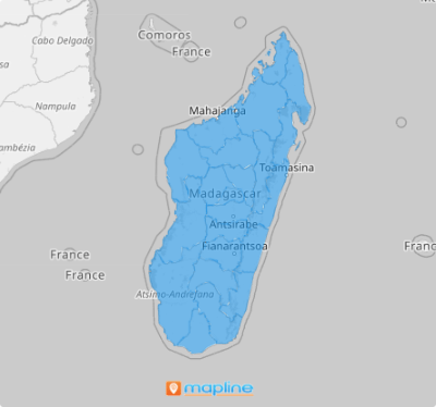
Enhance your analysis with a Madagascar region map! A region map does so much more than just display locations—it unveils the connections between different areas and their territorial boundaries. And the best part? Creating your map with Mapline is the easiest thing you’ll ever do! Just follow these simple steps, and in seconds, your map will be ready to transform your analysis.
ADD MADAGASCAR REGIONS
Make your map of Madagascar’s regions your ultimate toolkit for business success! Get ready to dive deep into trends and data at the region level, unlocking insights that will streamline your business efficiency like never before. With this powerful visualization, you can identify opportunities, optimize your strategies, and elevate your operations to new heights.
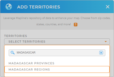
In 60 seconds – or less – add a new territory from Mapline’s repository. Type MADAGASCAR into the search bar and choose to add MADAGASCAR REGIONS.
One last step and we’re good to go.


Pro Tip: Mapline’s comprehensive territory repository includes boundaries in Madagascar including Madagascar provinces and regions. Explore other territories from different countries worldwide to gain more insights for your territory analyses.
CHOOSE REGION COLORS
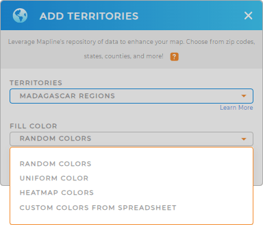
The final step is to incorporate your territory map with colors. A color-coded map is a powerful tool that enhances your ability to interpret data seamlessly and make informed adjustments to your business strategies. By strategically applying colors to your map, you can embark on a deeper analytical journey, highlighting key data points and uncovering trends that significantly impact your business.
Apply the best color styling, then click OK. Now, watch your map transform into a powerhouse of insights ready to be used to craft actionable strategies!

GET NEW TERRITORY INSIGHTS
Get ready to unlock even more territory management solutions by utilizing these advanced capabilities when analyzing your data on your region territory map:
- Optimize your routes to significantly reduce your overhead costs
- Run competitor data calculations seamlessly
- Add new dashboard and share information with your team for enhanced collaboration


