MALDIVES PROVINCES
- Territory Guide
- MALDIVES PROVINCES
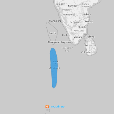
Visualizing Maldives provinces can have a powerful impact on your analytics as you design strategies that align with your business goals. Mapping out these provinces helps to capture key insights that help optimize your business operations. Imagine the impact of plotting provincial boundaries on your map: it’s like getting a backstage pass to the regional market trends and customer preferences. This clear view of how different areas interact with your data helps you optimize your operations with precision, ensuring that every move you make is backed by real, actionable intelligence.
Get first-hand knowledge of regional market trends and customer preferences by plotting the provincial boundaries on your map. Dive in, and see how harnessing these provincial insights can turn your strategic vision into a powerful, results-driven plan.
WHAT ARE MALDIVES PROVINCES?
The Maldives, a stunning island nation in Asia, was once divided into seven provinces, or “National Administrations.” Although these provinces were abolished as first-level administrative divisions in 2012, maps showcasing provincial boundaries remain a crucial tool for many businesses. They offer a clear and comprehensive view of your geographic scope, allowing you to see your business coverage across the entire nation.
By analyzing the intricacies of Maldives provinces, you gain immediate, actionable insights into regional performances. This enables you to craft and implement targeted strategies with precision, optimize your resource allocation, and drive your business forward with confidence. Harness the power of this visualization to transform your strategic planning and operational effectiveness.
ADD MALDIVES PROVINCES
Adding Maldives provinces to your map is a gateway to clearly understanding and interpreting your business strategies, improving territory analysis, and making strategic decisions based on location insights.
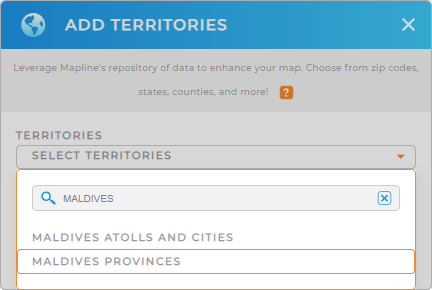
The first of 2 steps is to add a new territory from Mapline’s repository, type MALDIVES into the search bar, and select MALDIVES PROVINCES. This step lays the groundwork for a detailed regional boundary on your map.
There’s just one more quick step, and then you’re done.


Pro Tip: Mapline’s extensive repository of territory boundaries allows you to integrate regions from different countries into your map to intensify your global operational reach. Explore various territories, including Maldives atolls and cities and provinces, to get valuable insights for optimizing operations.
CHOOSE PROVINCE COLORS
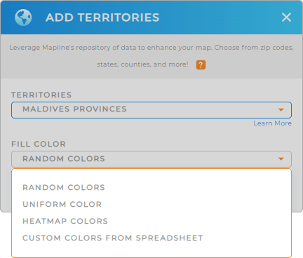
The last step is to color-code your map of Maldives provinces. Doing so significantly brings up clearer visualization to understand and interpret data. Colors also lead to a more effective analysis making it easier to identify patterns and trends, track performance, and optimize operations.
To achieve that, make sure to select your desired color styling.
Once done, click OK and start utilizing your map of Maldives provinces.

GET NEW TERRITORY INSIGHTS
Continuously refine your operations, marketing, and product strategies based on insights found on your map of Maldives provinces when you apply these capabilities:
- Optimize delivery routes and reduce travel time
- Customize reports on each province’s performance to effectively manage each region
- Create targeted marketing campaigns as you segment your data


