CYPRUS DISTRICTS
- Territory Guide
- CYPRUS DISTRICTS
Mapping Cyprus districts can significantly boost your brand’s strategic efforts. By leveraging district-level analysis, you can gain deeper insights into regional trends, optimize supply chains, and tailor marketing initiatives to specific areas. This overview shows how integrating Cyprus districts into your maps can drive informed decision-making and operational efficiency.
Let’s dive in and explore the transformative potential of district mapping for your business!
WHAT ARE CYPRUS DISTRICTS?
Cyprus is divided into six districts, which serve as the primary administrative divisions. These districts are crucial for local governance and regional planning. Brands can use district maps to analyze market penetration, manage distribution networks, and customize marketing strategies for different regions. Mapping districts provides a detailed view of regional dynamics, enabling more precise and effective business decisions.
ADD CYPRUS DISTRICTS
Incorporating Cyprus districts into your Mapline maps gives you new insight into your business and operations within the area.
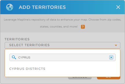
First, add a new territory from Mapline’s repository. Type CYPRUS into the searchbar and select CYPRUS DISTRICTS.
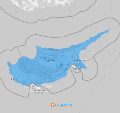
And BOOM! You just added precise district boundaries to your map. There’s just one more quick step, and then you’ll be ready to gain a granular understanding of district-level market dynamics.


Pro Tip: Leverage Mapline’s extensive repository of territory boundaries to unlock a global perspective of your operations. Add multiple territories to your map for a thorough regional analysis and more informed decision-making.
CHOOSE DISTRICT COLORS
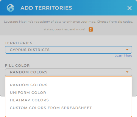
Applying colors to Cyprus districts is essential for improving data visualization and operational effectiveness. By color-coding, you can swiftly pinpoint performance metrics, regional patterns, and areas requiring focus.
Simply select your preferred type of colors from the drop-down menu, then click OK.
Now, your map is ready for in-depth regional analysis!

GET NEW TERRITORY INSIGHTS
But it doesn’t stop there! Leverage Mapline’s powerful mapping capabilities to unlock even more insights about your business and customers:
- Overlay your own list of competitor locations to analyze market competition and develop strategic responses
- Leverage Mapline Data to perform complex calculations and derive actionable insights from your territory data
- Visualize data denisty across districts to identify high-performing areas and opportunities for improvement


