MEXICO MUNICIPALITIES
- Territory Guide
- MEXICO MUNICIPALITIES
Get ready to revolutionize your strategy with a map of Mexico municipalities! Delve into the details like never before and unlock the full potential of location-based insights to boost your business operations. By mapping the fine details of Mexico’s municipalities, your brand can craft precision-targeted strategies that meet the unique demands of every customer segment, skyrocketing satisfaction and driving your business to new heights. Ready to dive deep into local market dynamics, fine-tune your sales territories, and supercharge your logistics?
Let’s unleash the power of municipal mapping and transform how you identify trends and optimize services across Mexico!
WHAT ARE MEXICO MUNICIPALITIES?
Mexico is a vibrant tapestry of 2,476 municipalities, each a cornerstone of local governance, bustling with life and opportunities as of March 2024. These municipalities are the heartbeat of public service, making them key to understanding and engaging with the community. Utilizing a detailed map of Mexico’s municipalities isn’t just useful; it’s essential for dissecting regional dynamics and injecting your strategies with data-driven insights that pinpoint the perfect markets for expansion and the ripest opportunities for investment.
Visualize the unique geographic and market dynamics at play, within the precise boundaries of each municipality and watch as complex patterns simplify into actionable insights. Ready to map your way to success? Let’s start now!
ADD MEXICO MUNICIPALITIES
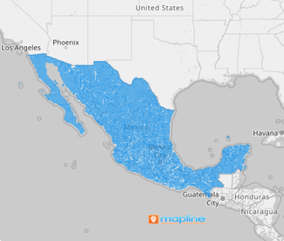
Overlay municipal boundaries to your map for enhanced visualization! Gather actionable insights by integrating a municipality territory map into your data analysis and make informed decisions to drive business growth! Speed up your analysis as you understand the spatial relationships between data and specific municipalities.
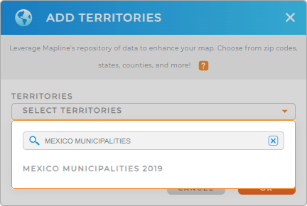
Achieve that by just following two simple steps. First, add a new territory from Mapline’s repository, type MEXICO into the search bar, and select MEXICO MUNICIPALITIES.
One more step to follow and we’re done.


Pro Tip: Mapline’s extensive list of territory boundaries enables you to add Mexico states and municipalities to your map, opening up a world of possibilities for global business management.
CHOOSE MUNICIPALITY COLORS
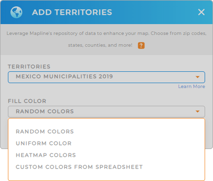
The second step is to color-code your municipality territory. A color-coded territory map helps speed up your decision-making process making it possible for the factors affecting your business to be identifiable at a glance. That means your analysis will be significantly trimmed down in half the time! How awesome is that?
Make that happen by assigning your desired territory color styles.
Once you’ve configured your color styles, click OK and you can now add your data to your map of Mexico municipalities for enhanced data analysis.

GET NEW TERRITORY INSIGHTS
Add these capabilities to your map of Mexico municipalities to intensify your data and territory analysis:
- Draw custom shapes to get an in-depth analysis of your data within a given area
- Track onsite job data to monitor your team
- Visualize teams segmented by sales leads by applying segments


