MONTENEGRO MUNICIPALITIES
- Territory Guide
- MONTENEGRO MUNICIPALITIES
Elevate your business strategy by unlocking a hidden dimension with a map of Montenegro municipalities. Dive deep into the granular boundaries to access insights that can be leveraged to sharpen your strategies. With this powerful tool, you can seamlessly spot intricate patterns and emerging trends, giving you the precision to fine-tune your approach like never before. Step into this enhanced perspective, and watch your business soar with impactful, game-changing results!
By employing a map with precise municipal boundaries, you gain the ability to analyze your customers and target market and understand how the distinct characteristics of each region impact them. This detailed approach highlights emerging trends and reveals opportunities tailored to each municipality.
WHAT ARE MONTENEGRO MUNICIPALITIES?
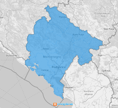
Montenegro, a hidden gem in the Balkans, sits proudly in Southeastern Europe, nestled on the stunning Balkan Peninsula. This small yet captivating country is divided into 25 municipalities. As the country’s first-level administrative subdivisions, they are the basic form of local self-government. They range from bustling urban centers to picturesque rural districts.
By analyzing different factors affecting your business alongside municipal boundaries, you can quickly uncover insights that enable you to craft hyper-local strategies tailored to your target market. For example, you can pinpoint which municipalities are key to reaching Montenegrin or Serb audiences. With this knowledge, you can fine-tune your marketing approach to effectively engage these specific communities, ensuring your strategies are both relevant and impactful.
ADD MONTENEGRO MUNICIPALITIES
Add municipality boundaries to your map in just a few seconds and unlock fresh, powerful business perspectives. With this added layer of detail, be equipped to make well-informed decisions that perfectly align with your business’s unique needs, driving smarter strategies and stronger outcomes.
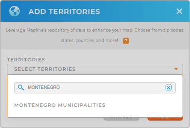
To add a new territory from Mapline’s repository, use the search bar to type MONTENEGRO and choose to add MONTENEGRO MUNICIPALITIES to your map.
This first step in crafting a customized municipality map is crucial for uncovering insights into your customers’ local needs. Equally important is the second step: choosing the right colors for your territory. Together, these steps provide a powerful foundation for more personalized and impactful business decisions.


Pro Tip: Explore territories from countries all over the world, including Montenegro municipalities, in Mapline’s repository of territory boundaries. Check out your data alongside different territories to develop a successful global business strategy.
CHOOSE MUNICIPALITY COLORS
The perfect color style not only enhances visual clarity but also helps you highlight key data points, making it easier to understand and act on the trends within each region. Transform complex data into actionable insights by harnessing the power of colors. By color-coding your municipality map, you can understand how your data aligns with specific territories in just a single glance. This visual clarity empowers you to make impactful decision-making.
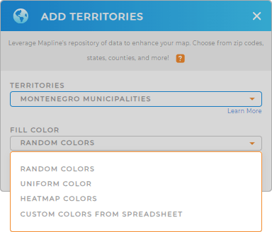
To color-code your territory, choose the best color styles from the selections – heat map, custom colors, uniform color, or random colors. Lastly, click OK to configure your settings.
Now that’s pretty sweet!

GET NEW TERRITORY INSIGHTS
With these powerful capabilities, you can reveal hidden patterns, make smarter decisions, and take your business strategies to the next level:
- Leverage innovative route optimization
- Access key data within your coverage areas
- Build a system that transforms your salesforcasting


