MOZAMBIQUE PROVINCES
- Territory Guide
- MOZAMBIQUE PROVINCES
Supercharge your analytics with a map of Mozambique provinces! Unlock deep insights to fuel smarter strategies and maximize ROI. Instantly spot regional trends, enabling your team to make data-driven decisions with confidence. Let’s say you’re a business owner looking to track team sales performance or evaluate risks affecting your stores. Or do you want to stay ahead of the competition? Look no further than Mapline’s territory mapping feature! By adding province territories to your map, you unlock invaluable insights into sales data, store risks, and competitive landscapes—all in just a few clicks!
Ready to dive in? Let’s walk through how to quickly add Mozambique’s provinces to your map and start analyzing your data today.
WHAT ARE MOZAMBIQUE PROVINCES?
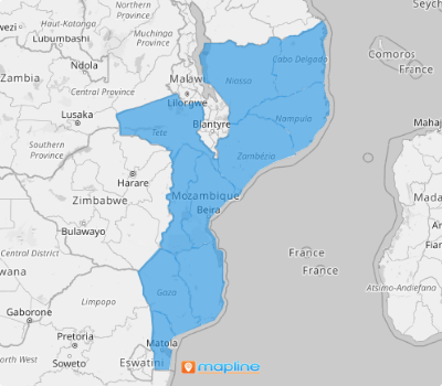
Mozambique is a country in southeastern Africa, known for its extensive coastline along the Indian Ocean and its rich cultural and natural diversity. It is divided into 10 provinces and a capital city, Maputo, the country’s largest urban center. Unlocking insights at the provincial level is the smart move for any business looking to stay ahead of the curve. With provinces as the country’s primary administrative units, tracking trends and spotting fresh opportunities becomes much more precise.
If your business stretches across multiple districts or municipalities, a province-level analysis is your key to staying in tune with market shifts, competitor actions, and customer needs. This approach helps you uncover opportunities tailored to each unique region, empowering you to make well-informed, strategic decisions that propel your business forward.
ADD MOZAMBIQUE PROVINCES
With province territory mapping, your business can easily spot which areas are on the rise, helping you stay ahead of emerging opportunities. This detailed map serves as a powerful toolkit for maximizing the impact of your visualizations.
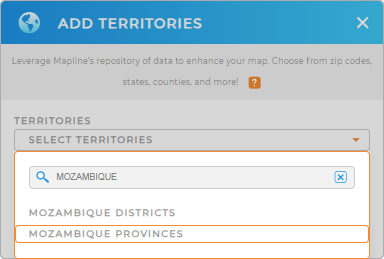
Here’s how to add these administrative divisions to your map in a snap. First, add a new territory from Mapline’s repository and type MOZAMBIQUE into the search bar to select MOZAMBIQUE PROVINCES.
It couldn’t be any easier than that!


Pro Tip: Harness Mapline’s Territory Repository to elevate your analysis. With a comprehensive collection of worldwide territory boundaries, including Mozambique districts and provinces, you’ll gain the precise tools necessary for in-depth territory analysis.
CHOOSE PROVINCE COLORS
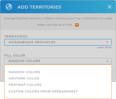
With the right territory added, it’s about time to color-code your territory map. Colors are a powerful visual tool that enhances your ability to make strategic decisions with clear, color-coded map. Why spend hours or even days analyzing when you can pinpoint critical factors in your territories in just minutes—or even seconds?
To transform your map into a visual powerhouse, select the best territory color styles. This approach brilliantly highlights critical data points, streamlining your decision-making process.
Once you’ve chosen your fill color, click OK. Now, you can start to identify trends in your map of Mozambique provinces.

GET NEW TERRITORY INSIGHTS
Dig in and extract valuable information as you uncover more valuable insights on your map using these capabilities:
- Sort your data in just a few clicks to identify pain points in a glance
- Analyze competitor data to gain a competitive edge
- Tailor your marketing campaigns within specific provinces


