MYANMAR DISTRICTS
- Territory Guide
- MYANMAR DISTRICTS
Unleash the power of your business by mapping Myanmar districts! Visualizing district boundaries unlocks key geographic insights, revealing trends and patterns that can transform your operations, marketing, and logistics. With Mapline’s dynamic territory visualizations, your team can design and manage highly targeted, location-specific sales territories with ease.
Let’s add these district boundaries to your map now to supercharge your business analytics, spot new opportunities, streamline resources, and expand your market reach. Leverage these insights to stay ahead of the competition and fuel your business growth!
WHAT ARE MYANMAR DISTRICTS?
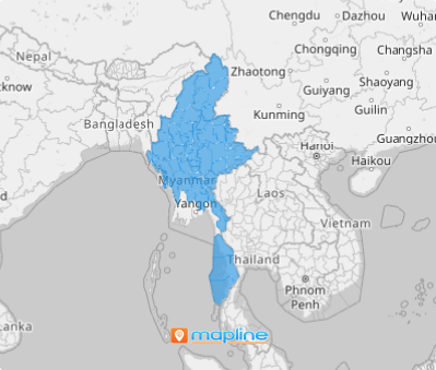
Myanmar, a landlocked country in Asia, is divided into 76 districts, each holding a wealth of insights waiting to be uncovered. Districts, the second-level administrative divisions in Myanmar, play a crucial supervisory role within its regions and states, overseeing the foundational townships that manage local governance. Mapping these districts can transform factors affecting your business into a powerful visual narrative. Each district boundary not only frames essential information but also reveals hidden patterns in locations, offering valuable, actionable insights. This approach allows you to see the bigger picture while diving deep into the unique dynamics of each area—turning complex data into strategic opportunities.
Let’s map Myanmar’s districts now to help you attain a crystal-clear view of regional strengths and untapped opportunities, empowering you to make smarter, data-driven decisions with confidence.
ADD MYANMAR DISTRICTS
Leverage district-level data to sharpen your marketing strategies, streamline supply chains, and elevate customer service. These administrative divisions are crucial for clearer insight into regional strengths and opportunities that help you make better decisions.
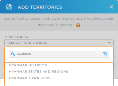
To add a new territory from Mapline’s repository, type MYANMAR into the search bar and select to add MYANMAR DISTRICTS to your map.
One quick step remaining and we’ll be done in no time.


Pro Tip: Leverage Mapline’s repository to explore regions from different countries worldwide including Myanmar districts, Myanmar states and regions, and Myanmar townships. Gain deeper insights for strategic decision-making as you add these territories to your map.
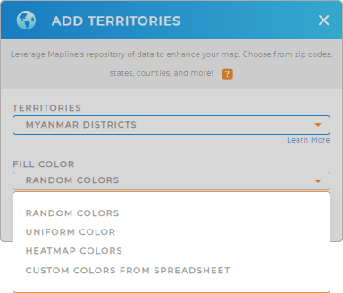
CHOOSE DISTRICT COLORS
Color-coding Myanmar’s districts takes your data visualization to the next level, making it easy to spot trends, assess performance metrics, and highlight areas that need immediate attention. This simple yet powerful tool helps you interpret data at a glance and take swift, informed action.
Mapline provides the best color styling options to choose from. Choose the one that you see fit for your type of analysis. Once you’ve configured your settings, click OK.
Now, you can optimize your data analysis on your newly created map of Myanmar districts!

GET NEW TERRITORY INSIGHTS
Spot more valuable insights to further your business operations across all Myanmar’s districts by utilizing these capabilities:
- Use color-coded concentrations for clearer visibility into your customer and sales activity
- Add competitor data to give you a leg up over the competition
- Access detailed territory reports to structure data-driven strategies


